
My wife and I recently finished a wonder-filled twelve-day road trip through Utah and the Four Corners region of the US Southwest. We visited seven national parks and monuments, three state parks, one tribal park and many other points of interest along the way. This is an incredible part of the country, and I wanted to share some of our experiences and a tiny sample of our photos.
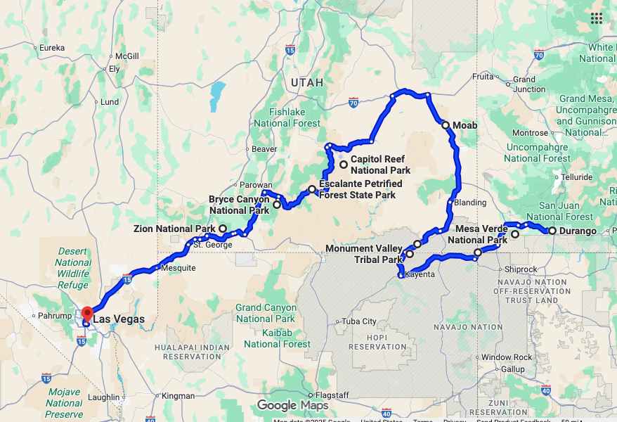
The map below shows our route starting in Durango, Colorado and ending in Las Vegas, Nevada. At the airport in Durango, which we reached via a short connecting flight from Denver, we picked up a rental car, a blue Mitsubishi Outlander. We then headed immediately west to our first stop, Mesa Verde National Park.
Mesa Verde National Park
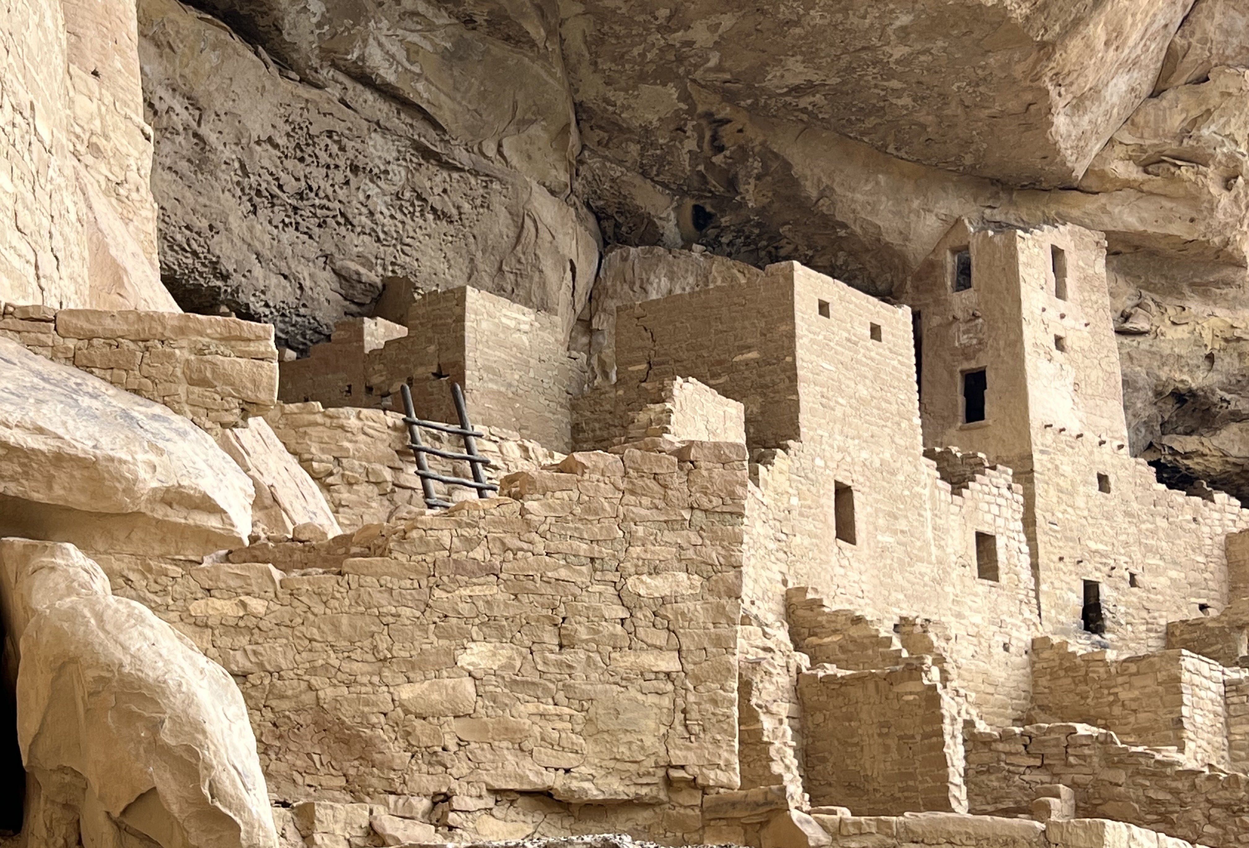
Mesa Verde is a World Heritage Site famous for the ancient cliff dwellings of the Ancestral Pueblo people (formerly called Anasazi). The Pueblo lived on the mesa and in its cliffs for over 700 years and then abandoned the area over a couple of generations starting in the late 1200s AD.
Historians still don’t know exactly why they moved away. The most likely reason was climate change: a 60-year drought that would have caused food shortages. But there are also indications of social conflict too, possibly brought on by declining food supplies. (Michael Mann warns in his book Our Fragile Moment that the collapse of the Mesa Verde civilization shows that we may be underestimating how fragile our societies are when subjected to climate-driven stresses.)
The highlight of our visit to the park was a Ranger-guided tour through the Cliff Palace. It was truly amazing to walk through the remains of this elaborately constructed settlement built right into the cliff face. The Puebloans knew what they were doing. They had a sophisticated understanding of engineering and construction methods. Their homes are still standing 700 years after they left.
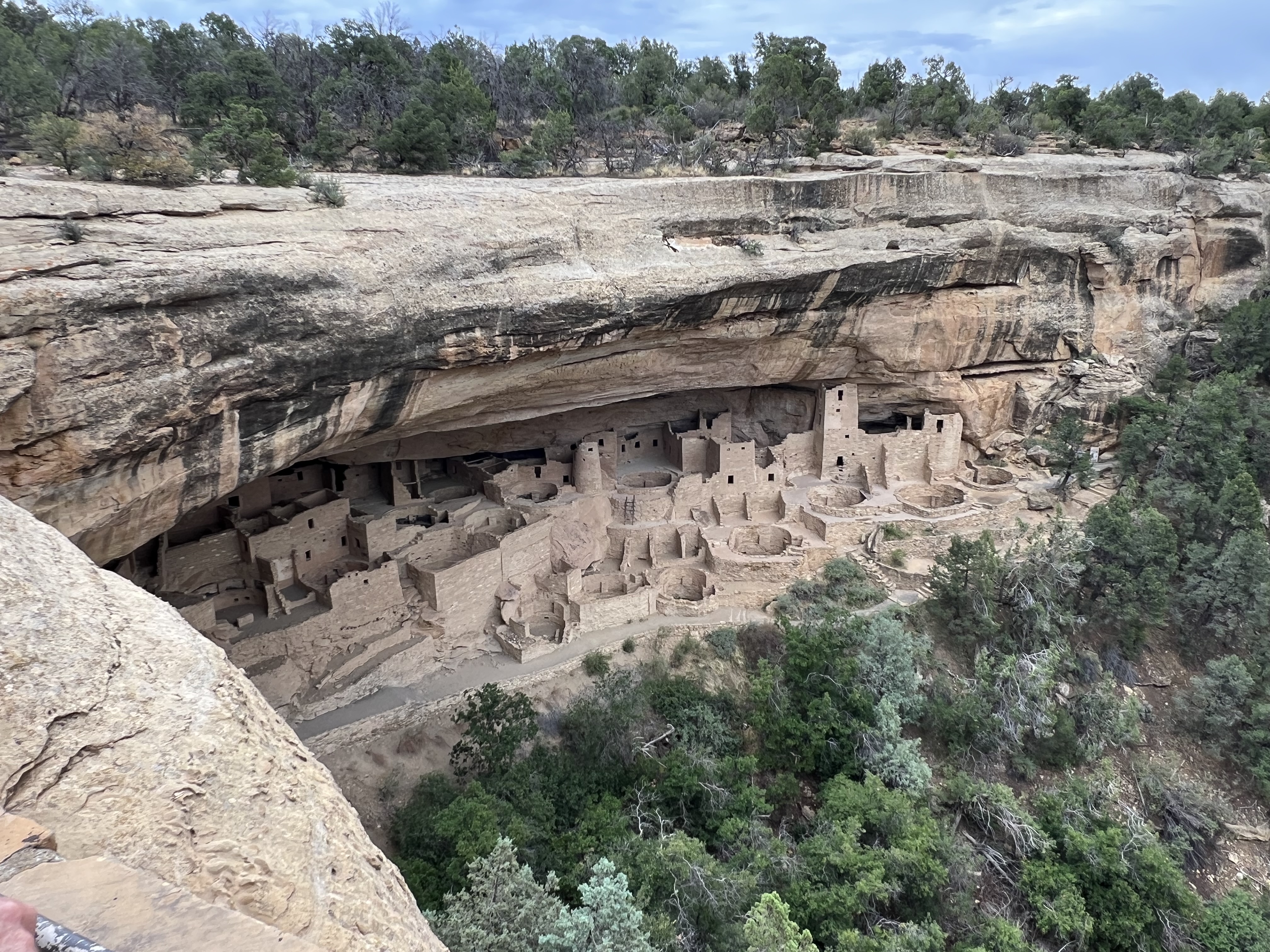
Just for fun, we tried to come up with a one-word description for each of the parks we visited. Mesa Verde’s cliff dwellings inspired us to choose “intimate.”
Four Corners Monument
Our next stop, the Four Corners Monument, marks the place where the borders of Colorado, Arizona, Utah and New Mexico meet at right angles. It’s a completely arbitrary point in the middle of nowhere with not much to see or do except take a quick photo and leave. Which we did.
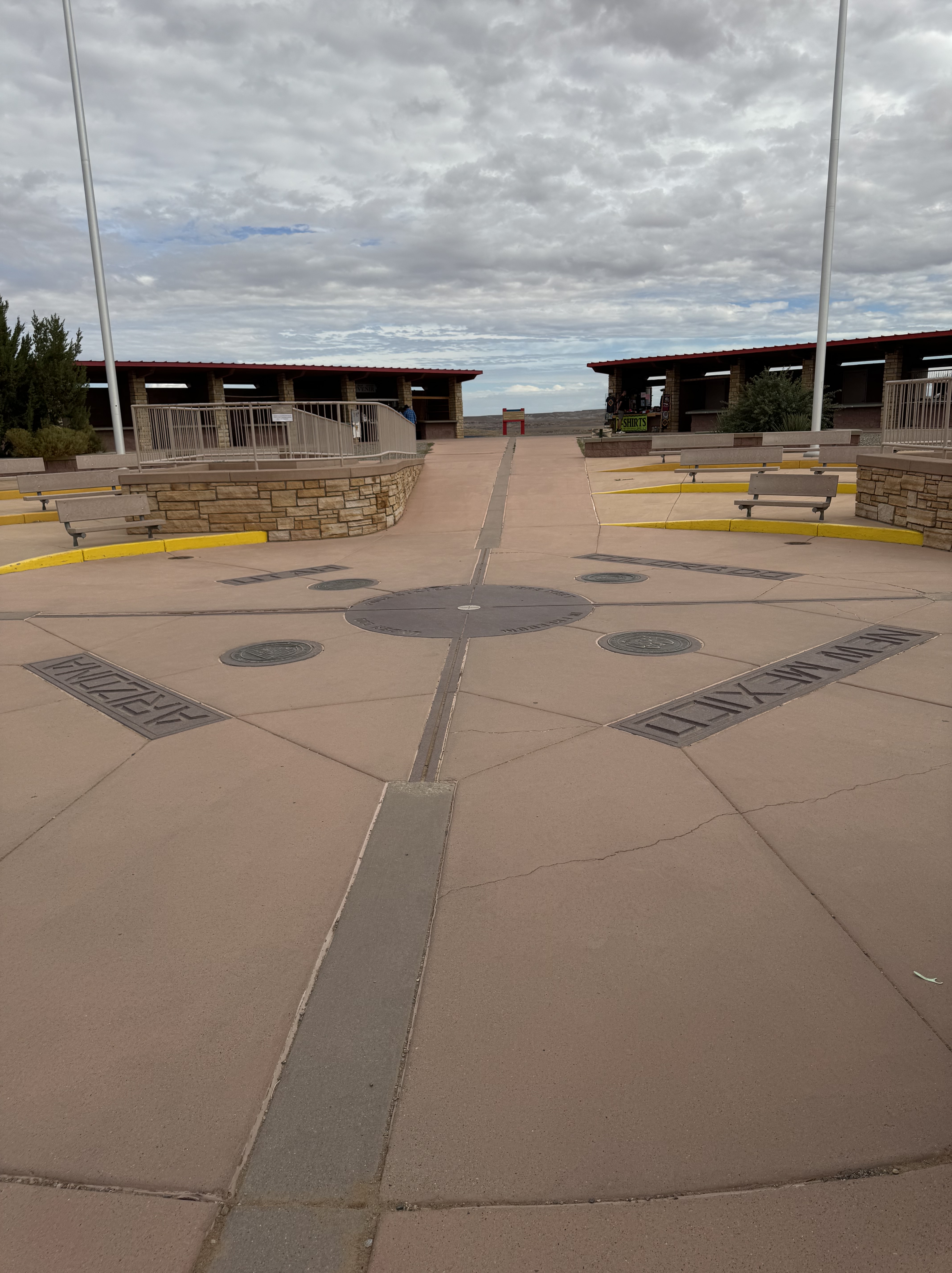
Maybe I’m being a little harsh. The monument is situated on Navajo land and it’s technically a Navajo Tribal Park. There are stalls set up around the perimeter of the monument where you can buy locally made handicrafts.
From Four Corners, we drove southwest along US Route 160, stopping for a very nice lunch at the Amigo Café in Kayenta, Arizona and then headed north up US Route 163 to Monument Valley.
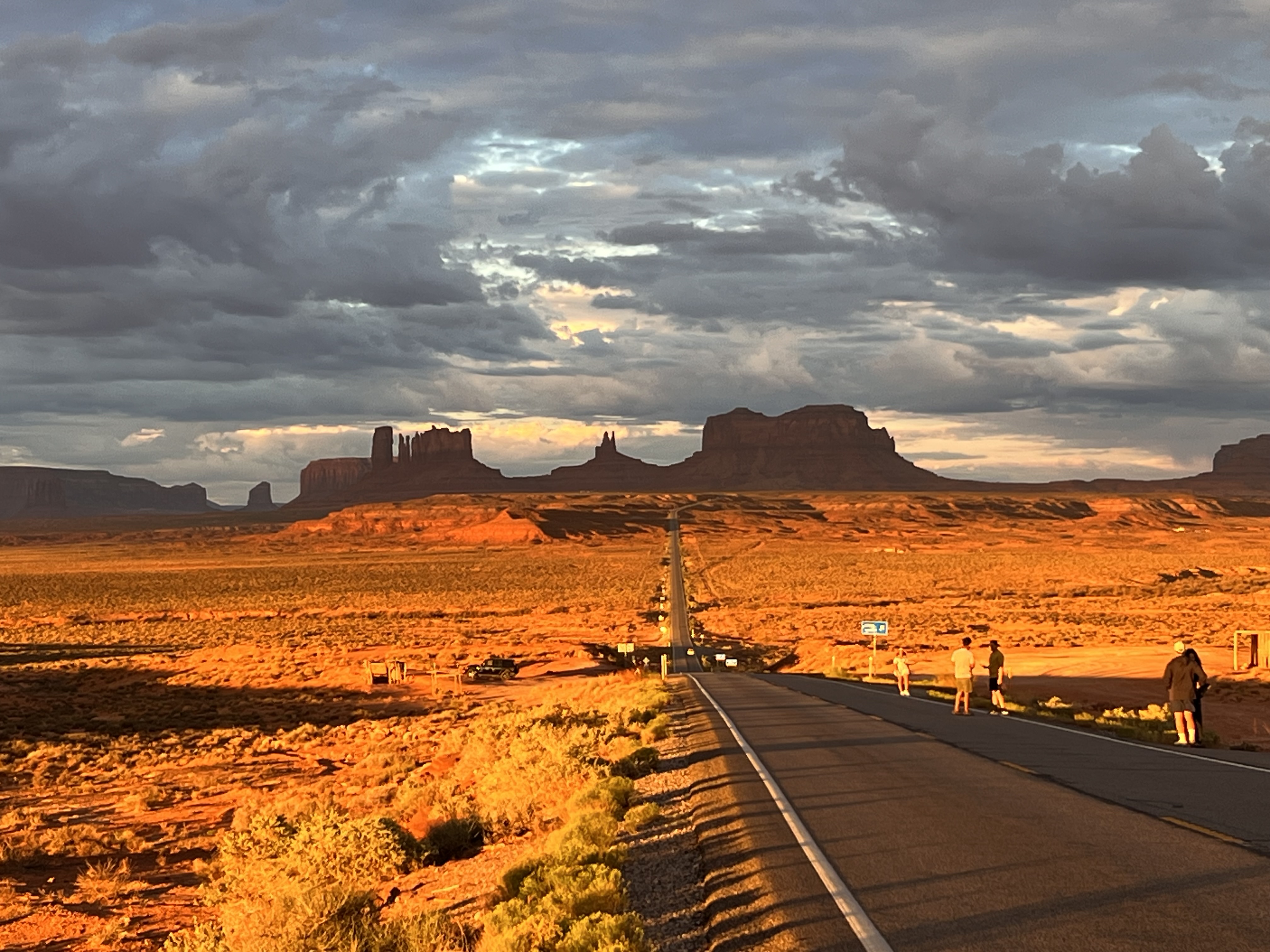
Monument Valley
The “monuments” at Monument Valley Navajo Tribal Park are the sandstone buttes, spires and pinnacles that grace this fantastical landscape. Many have been used as sets or backdrops for Hollywood movies. Our one word for Monument Valley is “majestic.”
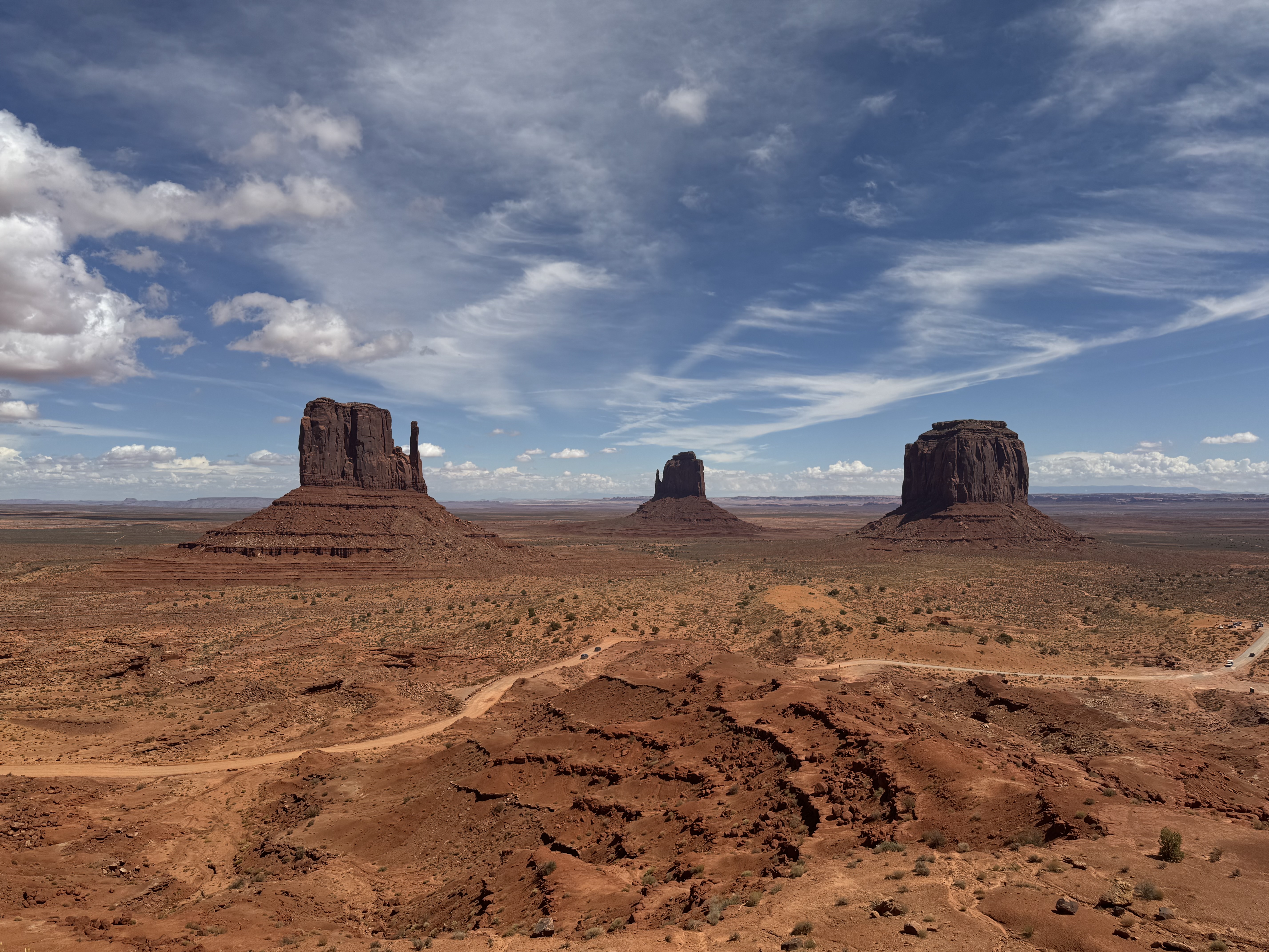
There’s a 17-mile loop through the park which we did not even attempt to drive. You really need a four-by-four vehicle to do it safely. We booked a 2.5-hour tour from the Navajo-run Dineh Bekeyah Tour company. It was fabulous. Our Navajo guide, John, drove us all over the valley, on- and off-road, taking us to notable features and giving us an oral history of the area and his people. This was the most memorable and informative guided tour of the whole trip.
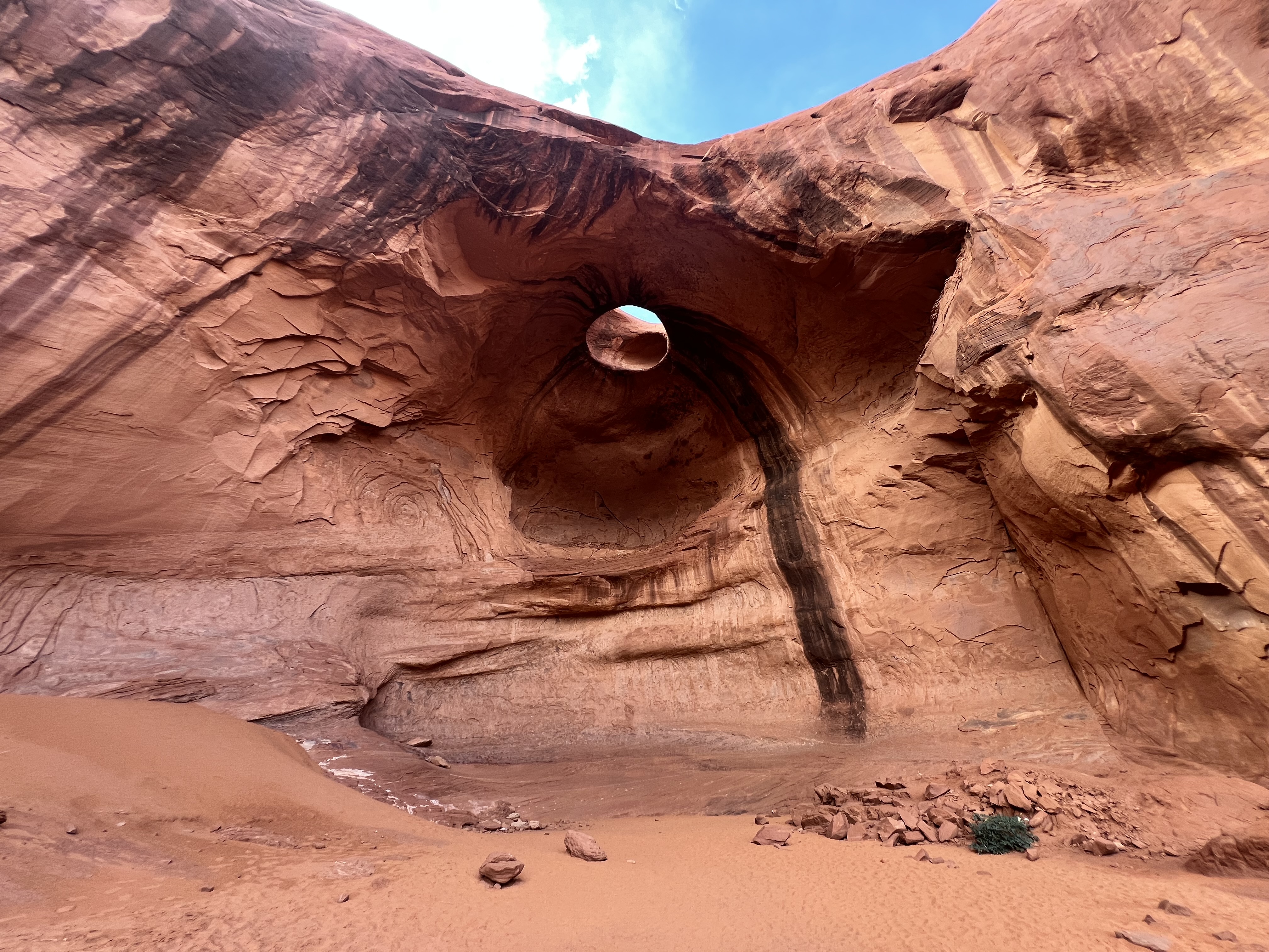
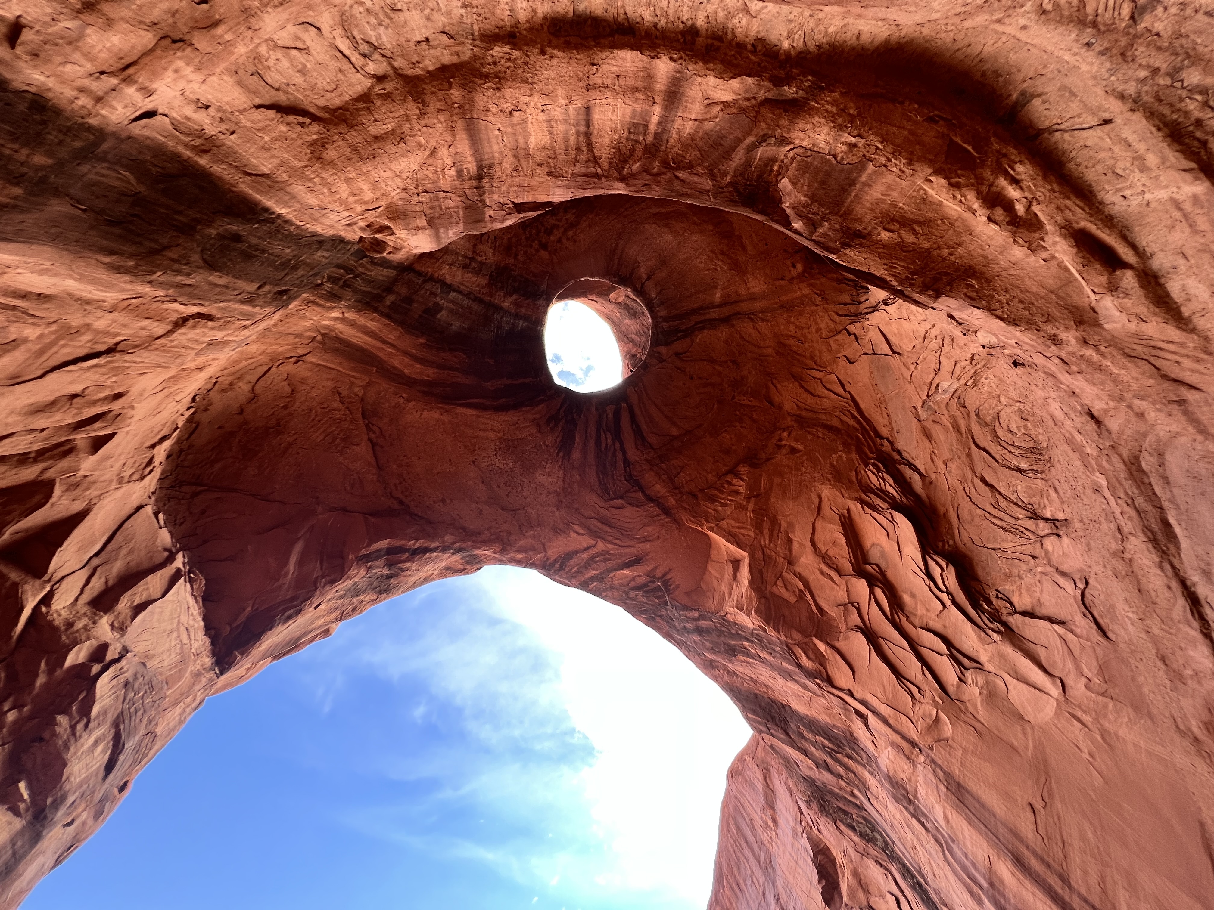
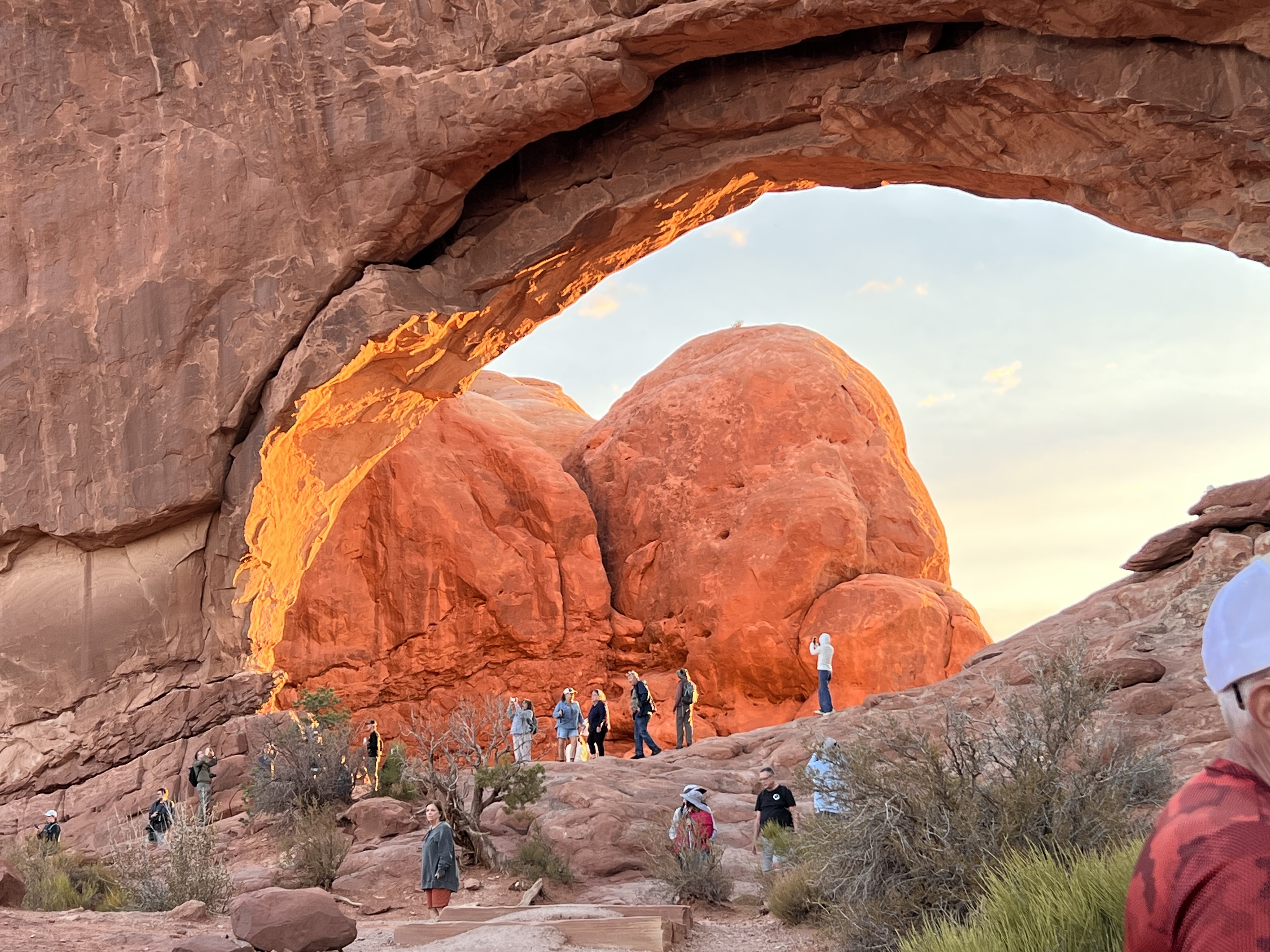
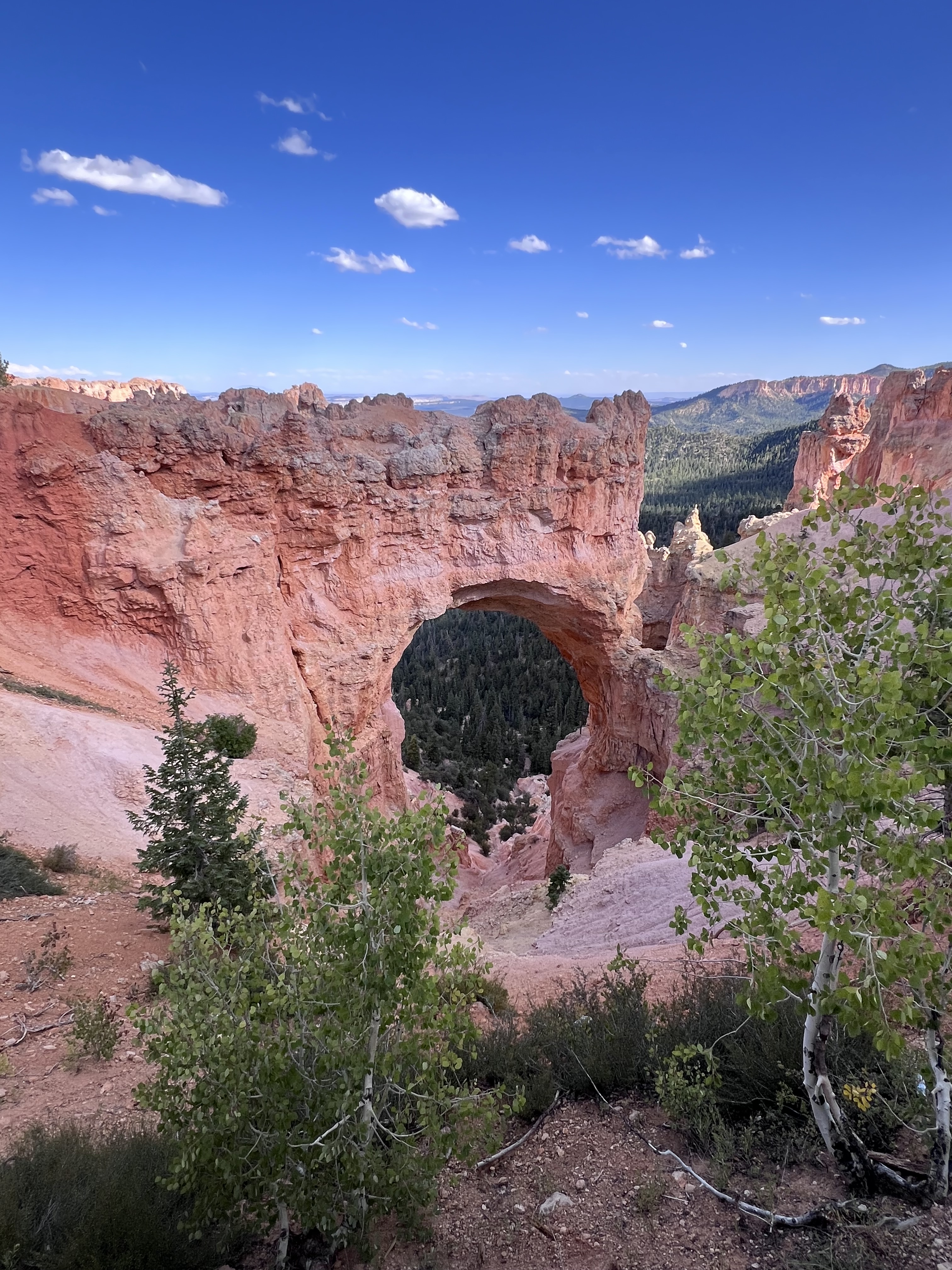
Big Hogan Arch was one of the highlights of our excursion.
Sadly, climate change is starting to affect this area too. John told us that higher temperatures have made this already arid location even drier which has caused much of the wildlife to disappear for lack of water.
A Note about Geology
If you visit Florence, you learn about art. If you visit Chicago, you learn about architecture. When you visit to Utah, you learn about geology. We learned a little geology from Ranger talks and a bit of reading, but I admit I still don’t have a clear grasp of how the area evolved. However, to set the scene, here’s a brief hand-wavey overview.
Utah and the Four Corners area are located within a larger geological “province” called the Colorado Plateau. The Colorado Plateau is a single block of the Earth’s crust that has remained remarkably stable over hundreds of millions of years. Stable in the sense that there are few major fault line or folds that might cause it to break apart. But it’s still gone through remarkable changes.
The three main geologic forces acting on the area, we learned, are deposition, uplift and erosion. Deposition refers to the laying down of sediments – sand, silt and mud – thousands of feet thick in various layers and colors, especially iron-rich sediments that gives the area its iconic red rocks. The whole area was once part of a giant inland sea.
Uplift is the tectonic movement of the Earth’s crust, often the result of plate movement or pressure from upwelling magma. Millions of years ago, the Colorado Plateau was uplifted as a single block of crust about the same time the Rocky Mountains were forming to the east.
Finally, erosion, from water (rivers, rain and ice) and also wind, created the incredible landscapes and features for which the area is so famous. While all this was happening, the continents themselves were moving around, breaking apart and recombining. So a lot of action over the last few hundred million years. Actually, I shouldn’t use the past tense because these processes are still going on. It’s complicated!
Anyway, the result of all this is that no matter where you go, you’re ether standing at the top of a canyon looking down, or at the bottom of a canyon looking up. But it’s all the same chunk of the Earth’s crust.
OK, back to our trip.
The Road to Moab
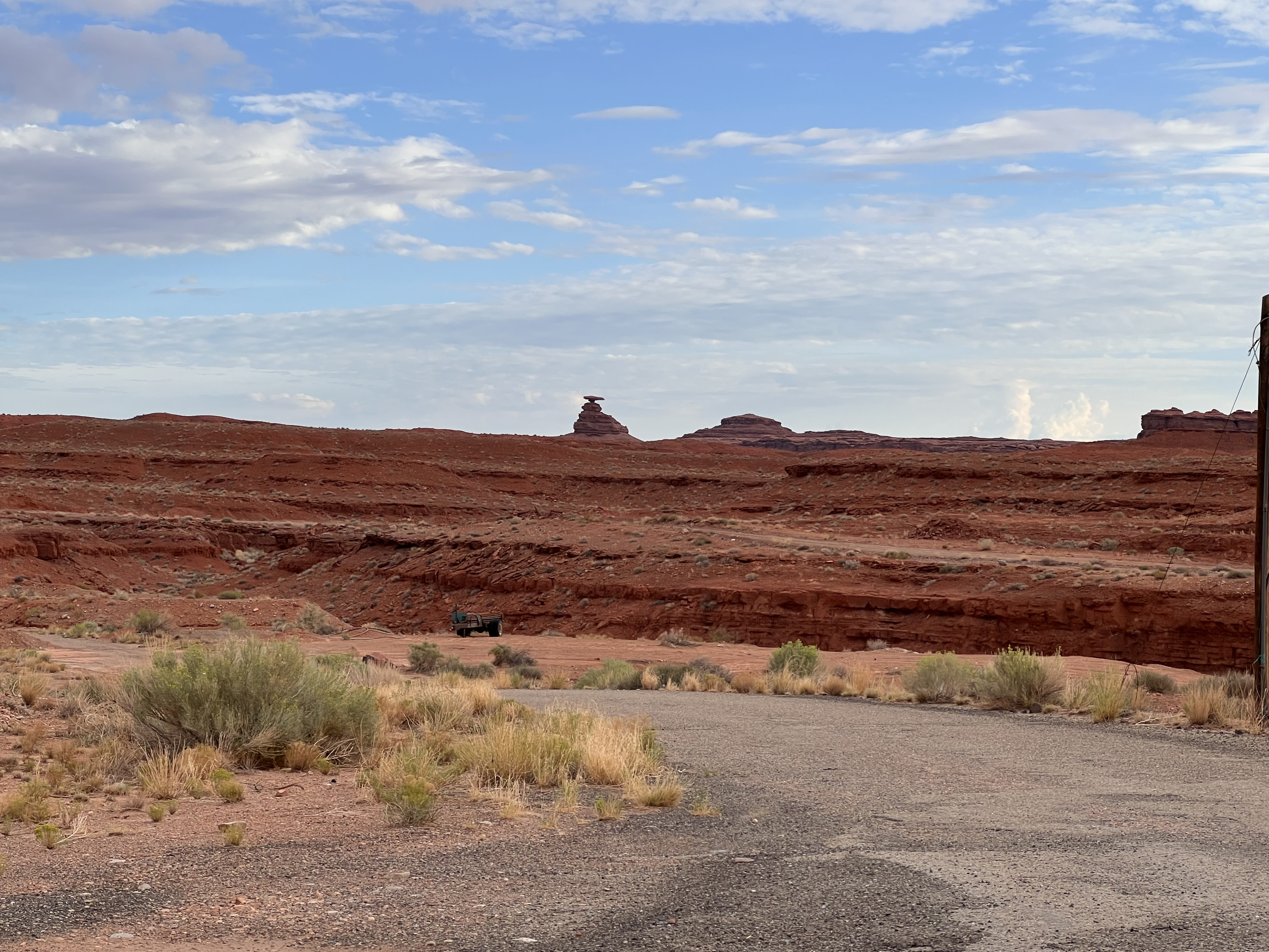
From Monument Valley we drove up US Routes 163 and 191 to Moab, staying overnight along the way in the small town of Mexican Hat located on a bend of the San Juan River. The town is named for a nearby rock formation that looks like a sombrero.
The road to Moab offered a great preview of some of the sights and attractions we would see in the Moab area itself. Many of these are lesser-known spots but still worth a brief visit.
Forest Gump Point, on US Route 163, just south of Mexican Hat, marks the spot where Forest Gump ends his cross-country run in the 1994 movie. From this vantage point, you get a spectacular view of Monument Valley to the south. The place is easy to find: just look for the crowd of people standing in the middle of the highway. We missed the exact moment of sunrise by a few minutes but still got some great photos.
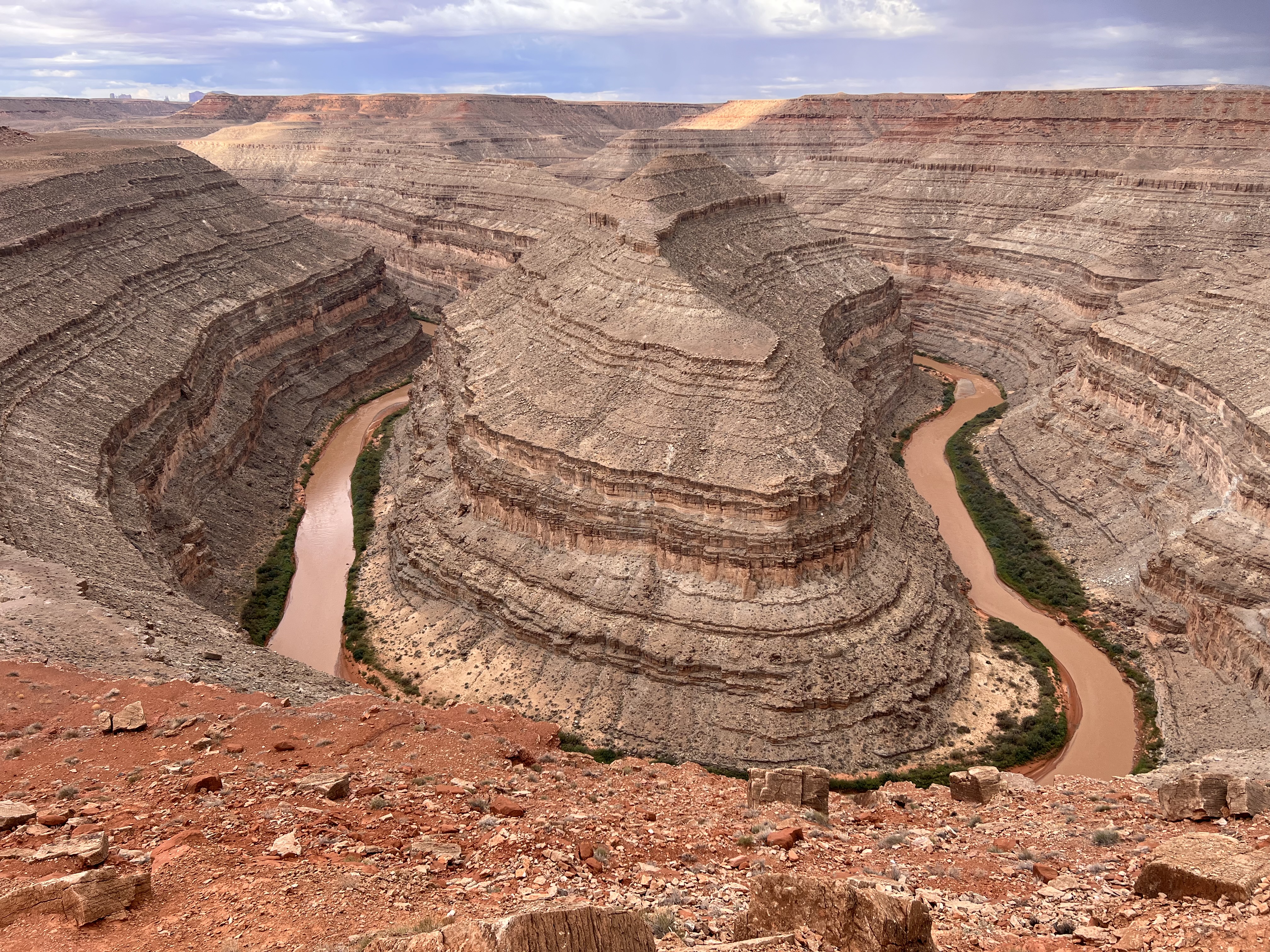
Just north of Mexican Hat, we made a brief detour to Utah’s Goosenecks State Park. It’s a small park that offers a great overlook to sharp gooseneck-shaped bends in the San Juan River. Over a couple of hundred million years, the river has carved its way down through about a thousand feet of rock. (This is a great example of why Erica Gies titled her book Water Always Wins.)
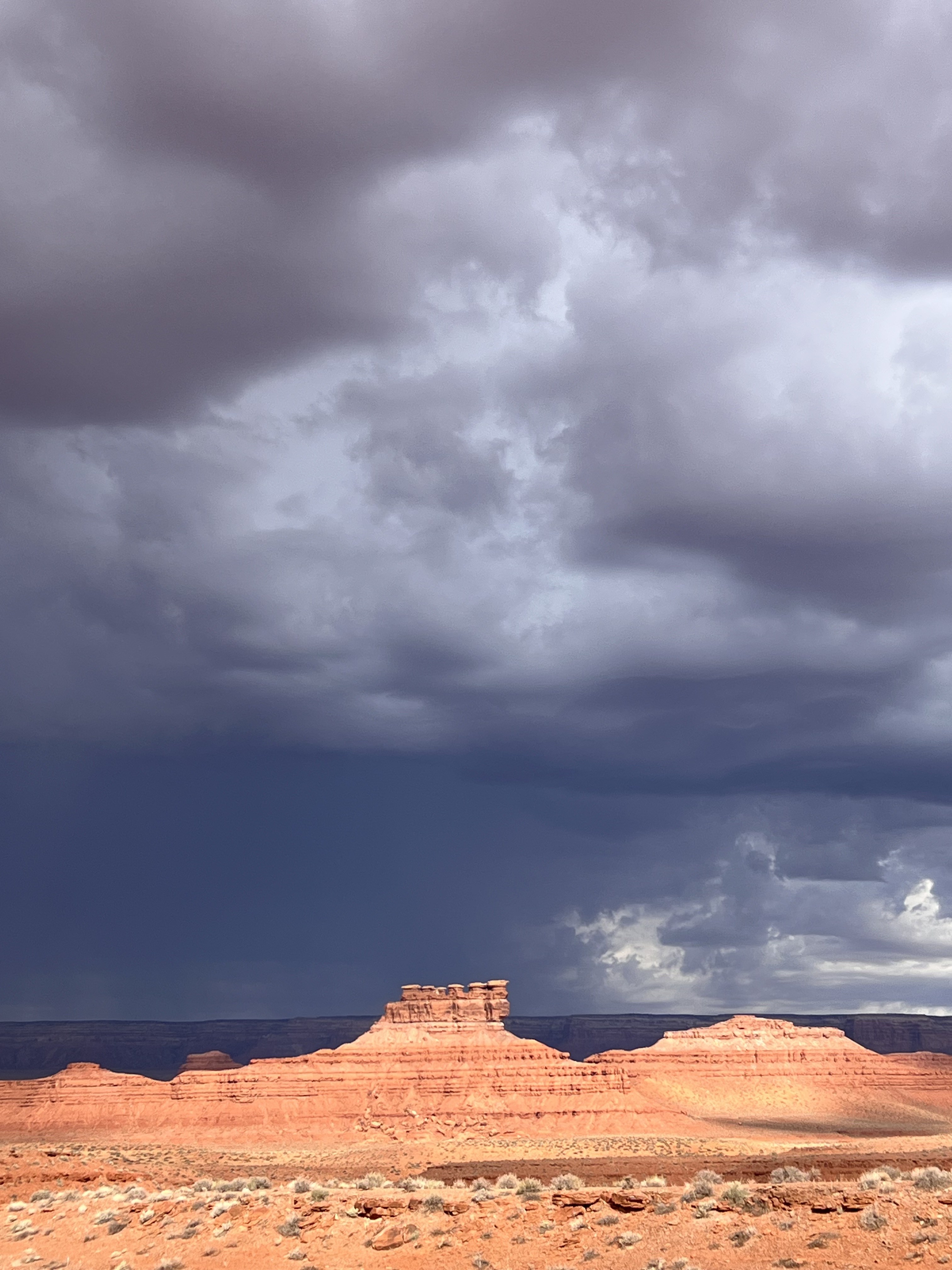
We continued northeast up US 163 through the Valley of the Gods. It’s very similar terrain to Monument Valley with lots of buttes and other rock formations. We were chased by thunderstorms up the valley, and the clouds were wonderfully dark and ominous.
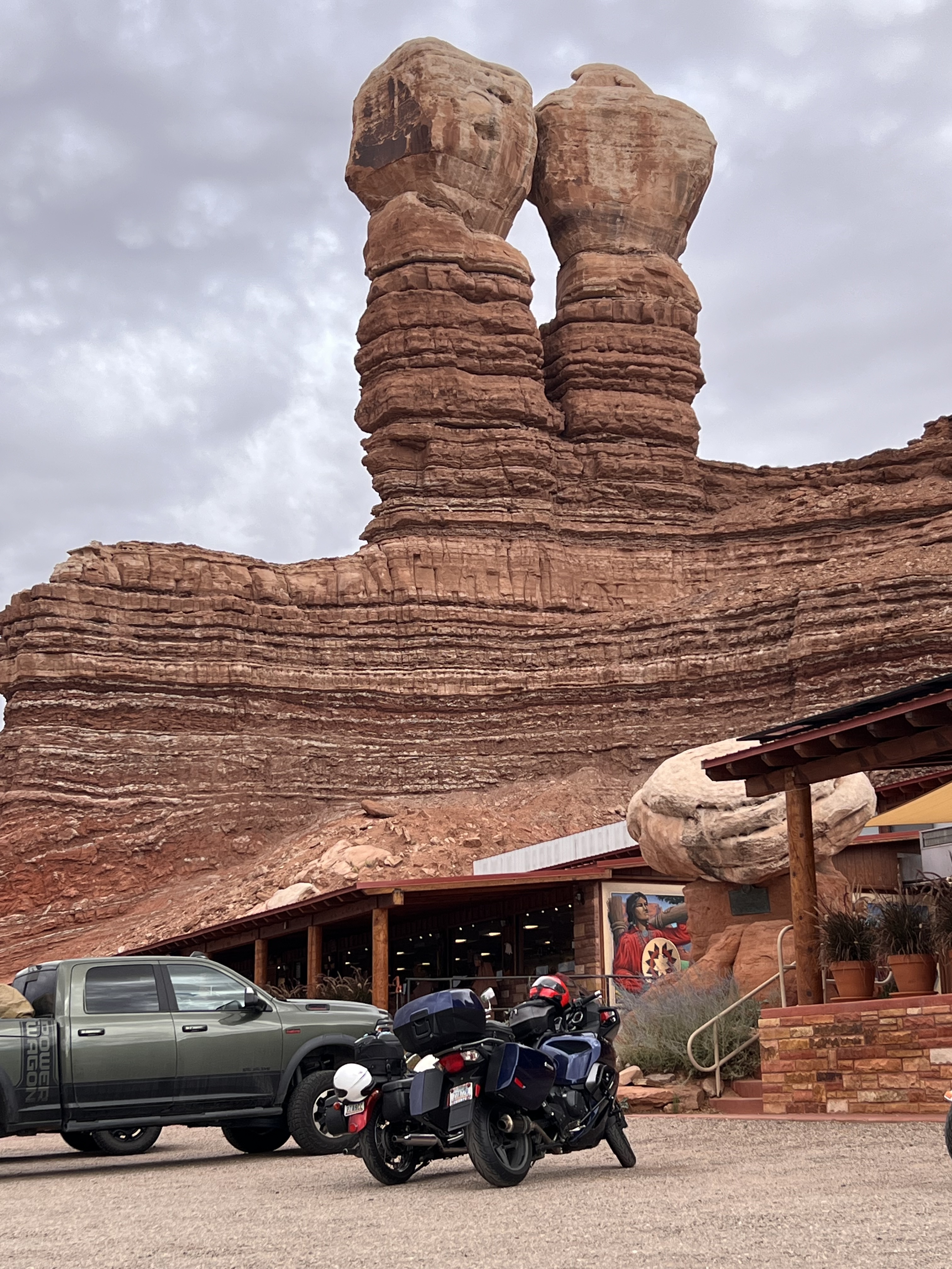
We proceeded on, stopping for a late breakfast at the aptly named Twin Rocks Café in Bluff.
Moab
We reached Moab by mid-afternoon and checked into our hotel, the Best Western Plus Canyonlands Inn. We stayed there for four nights and I have to say the hotel exceeded our expectations. The room was spacious and comfortable. We enjoyed cooling off in the pool each afternoon. And the sparrows and ravens were amusing company each morning on the deck where we ate breakfast. The hotel even has coin laundry facilities which we took advantage of because we only travel with carryon luggage.
Moab was the only sizeable town on our entire trip. It’s a tourist town for sure, but it’s central to Arches and Canyonlands National Parks and several other attractions. It offers a good selection of hotels, restaurants, outfitters and shops. One downside is that US 191 forms the main street of the town and it seems to be a major truck route. This makes the downtown area very noisy.
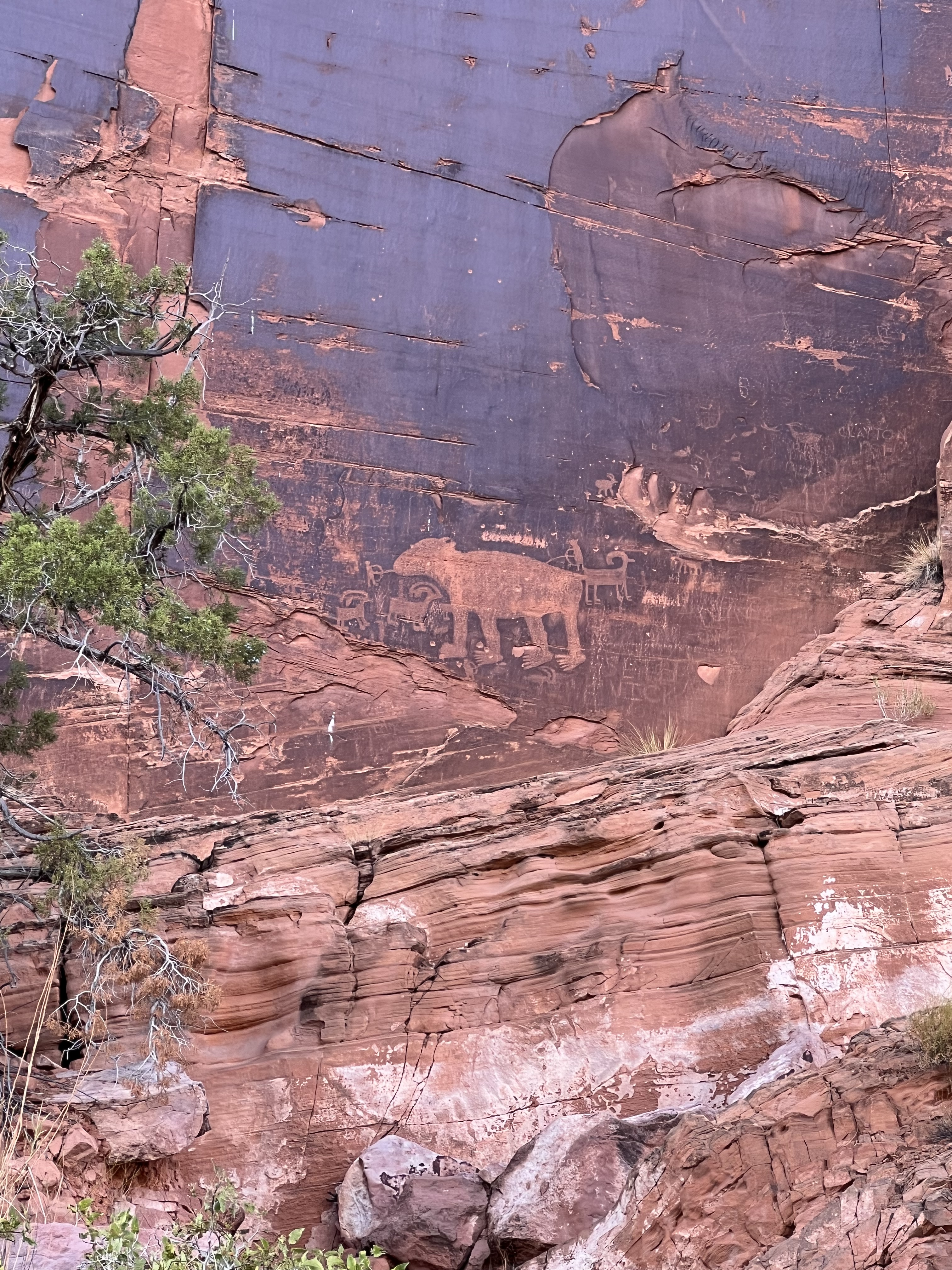
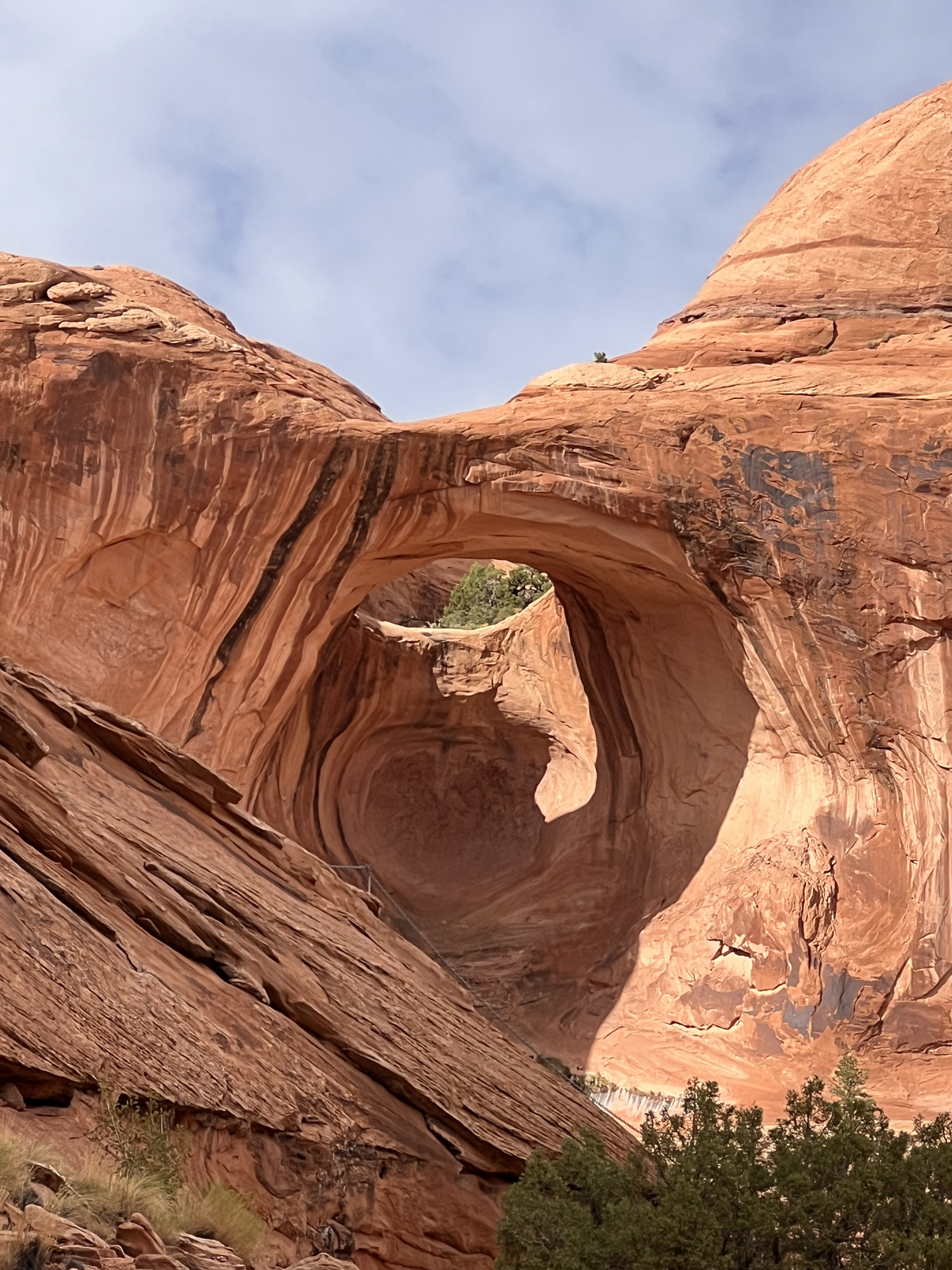
After a brief rest and walk around Moab, we headed out for a hike to Corona Arch. The trailhead is located a few miles northwest of the town on Utah State Route 279, aka Potash Road, aka “Wall Street.” It’s called Wall Street because part of the road passes very close to a sheer rock wall that’s popular among rock climbers and also features ancient petroglyphs.
The Corona Arch trail is rated moderately difficult – there’s a ladder and chain section at the very end — but we’re not adventurous hikers so we found it quite a challenge. It gave us our first introduction to “slickrock” which, as the name suggests, is very smooth, slippery rock treacherous to walk on. We didn’t quite make it all the way to Corona Arch but we did get to Pinto Arch.
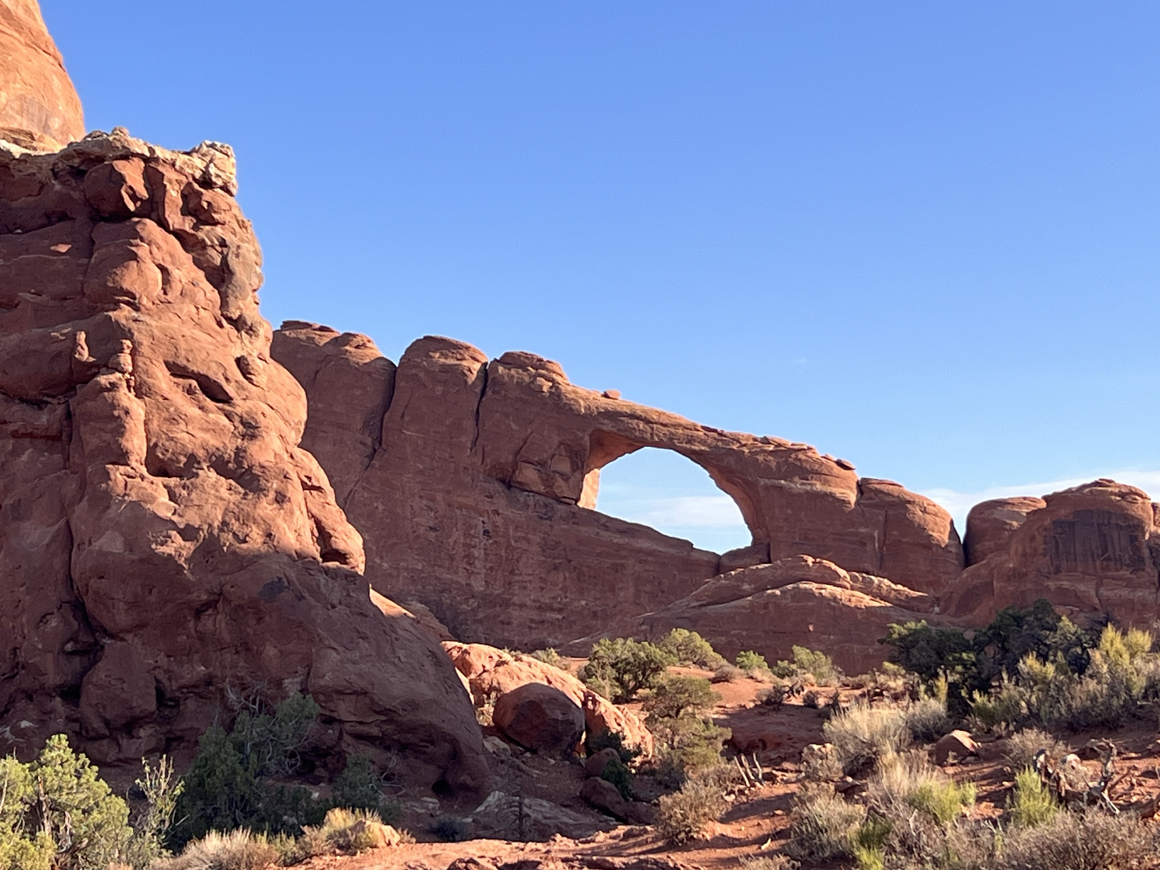
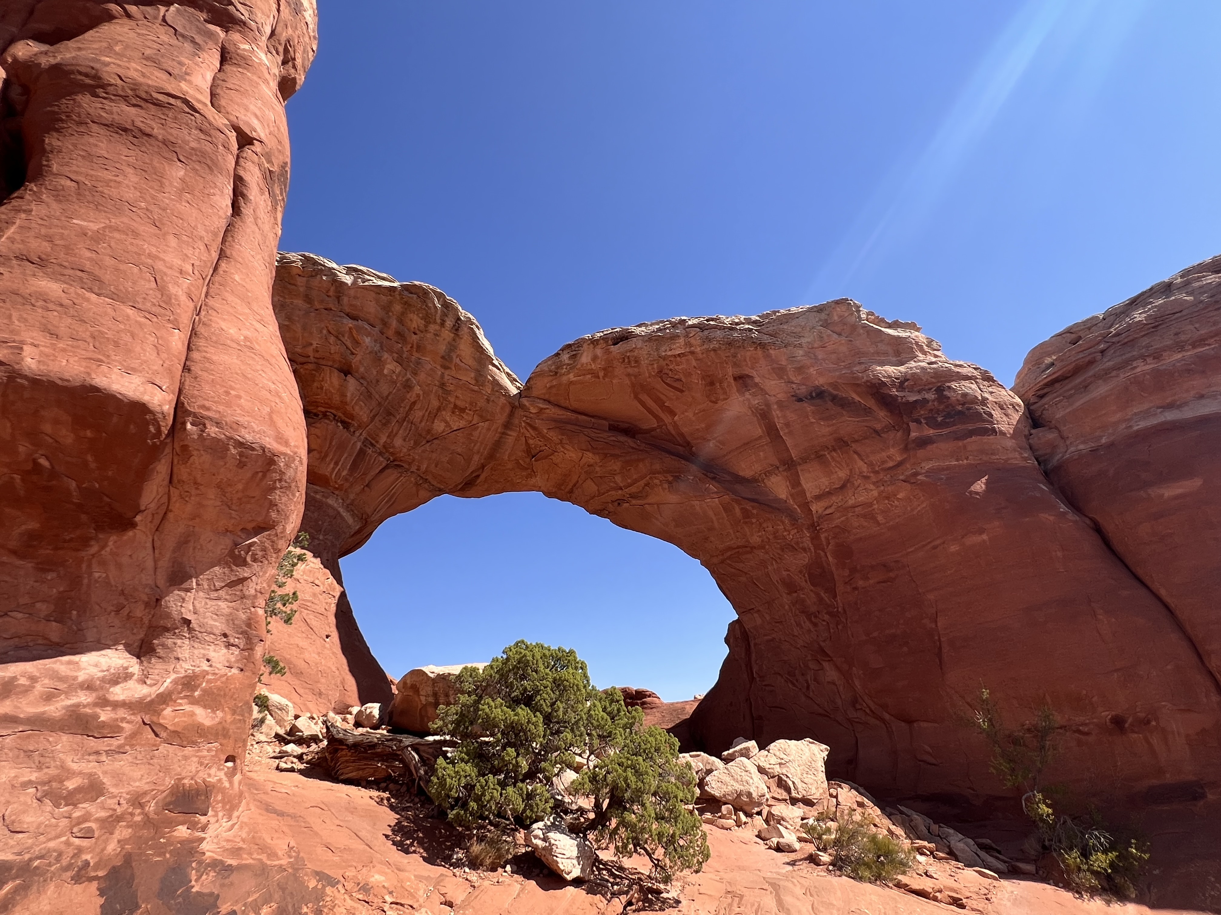
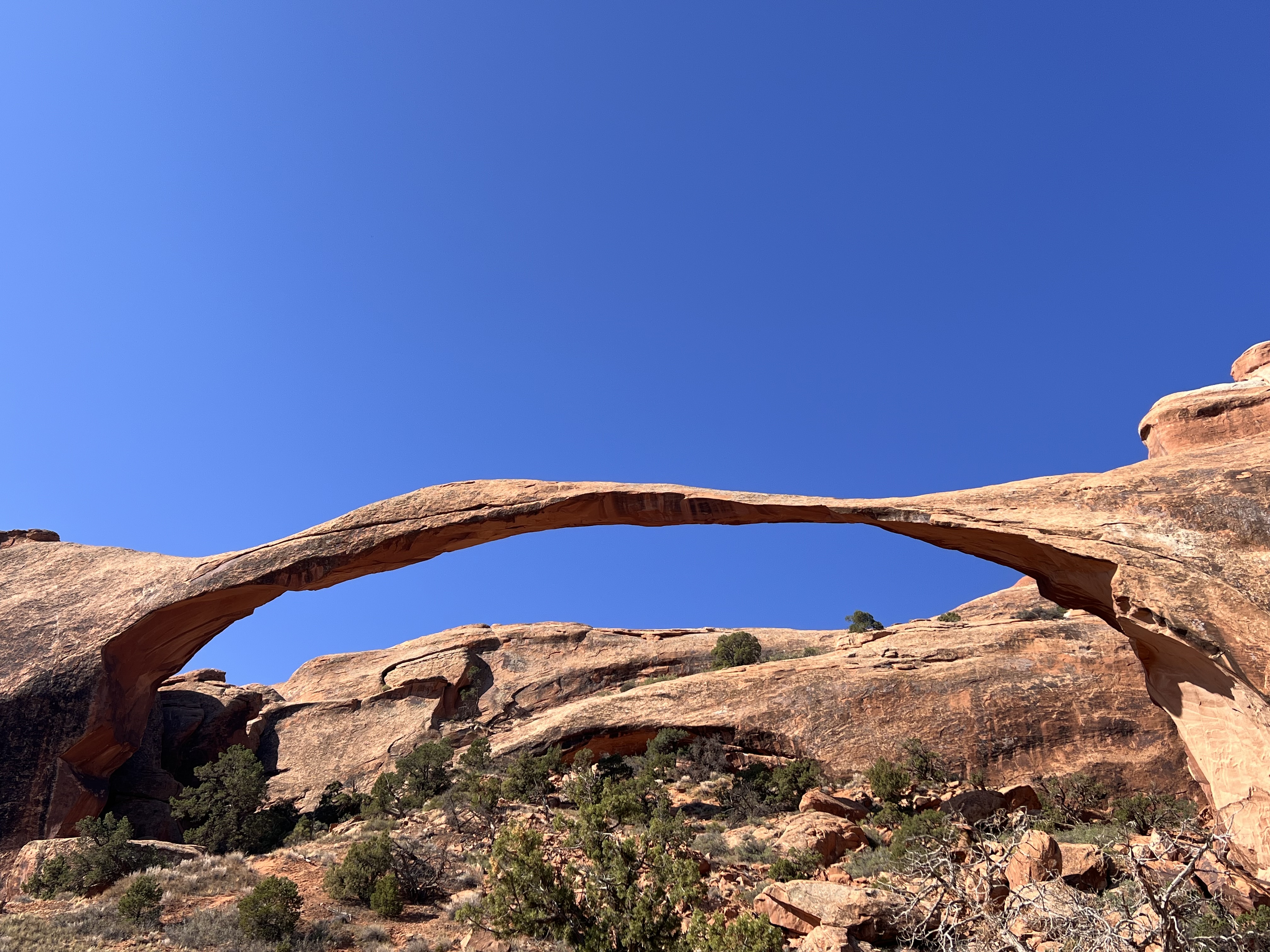
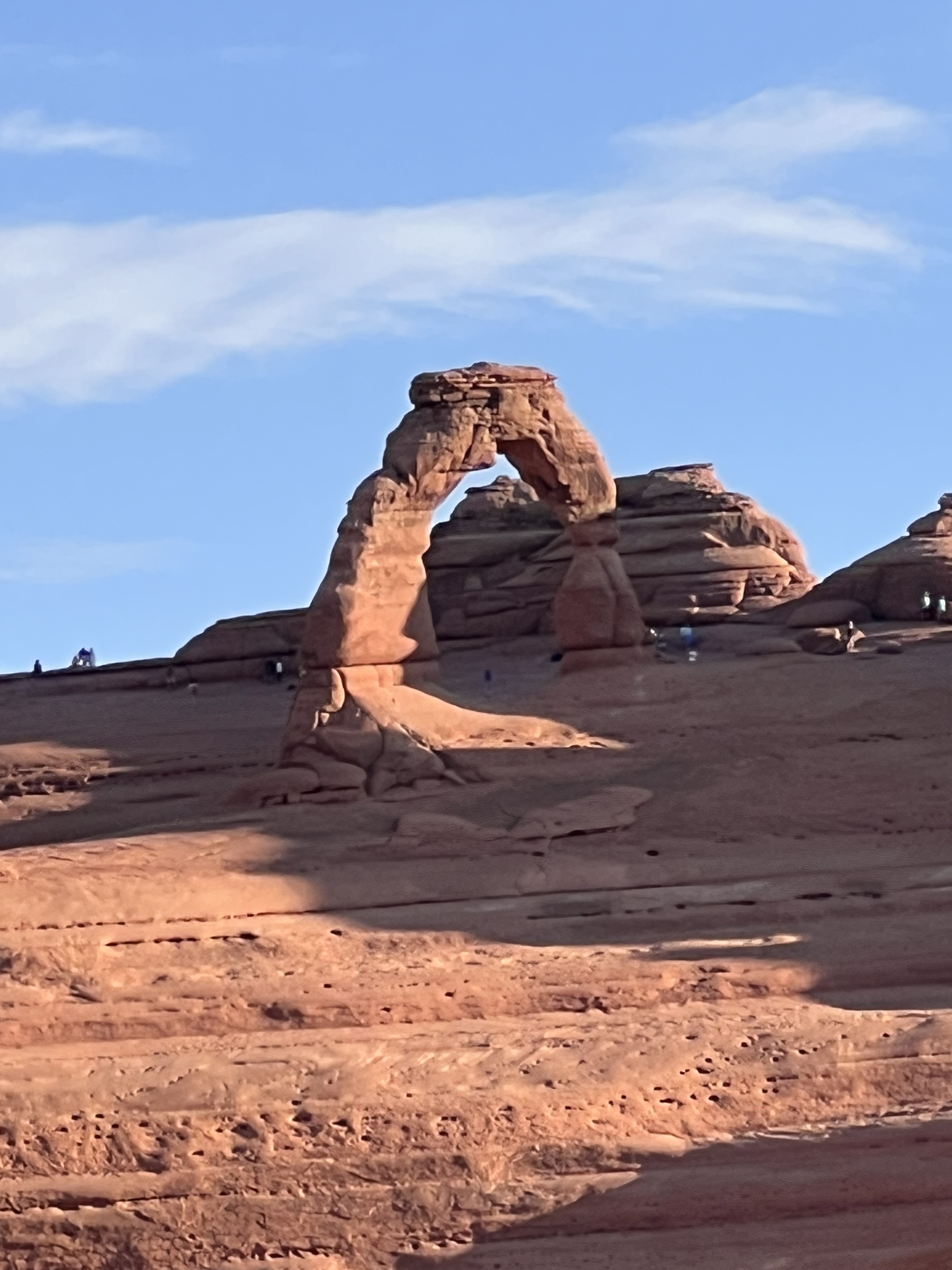
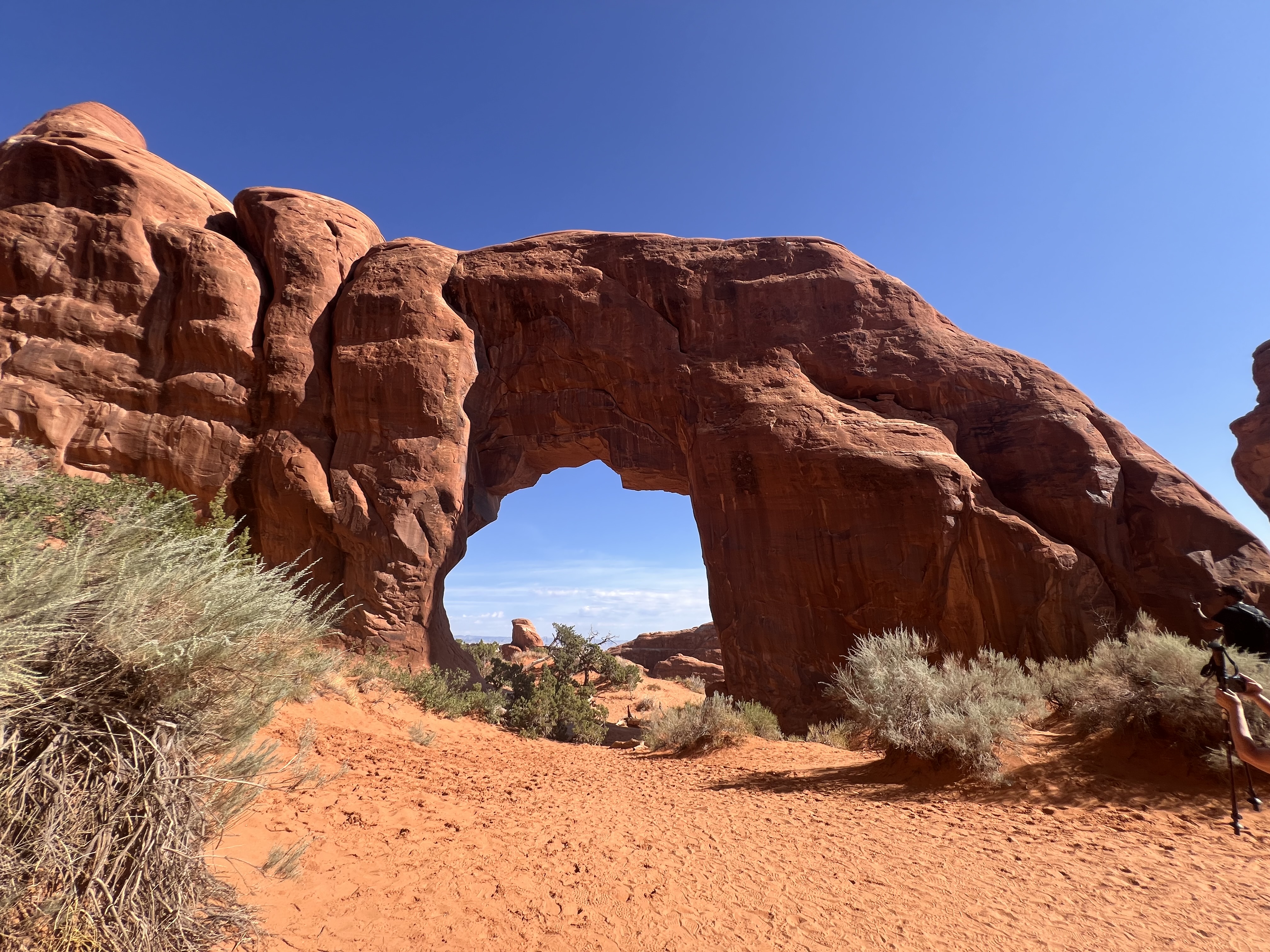
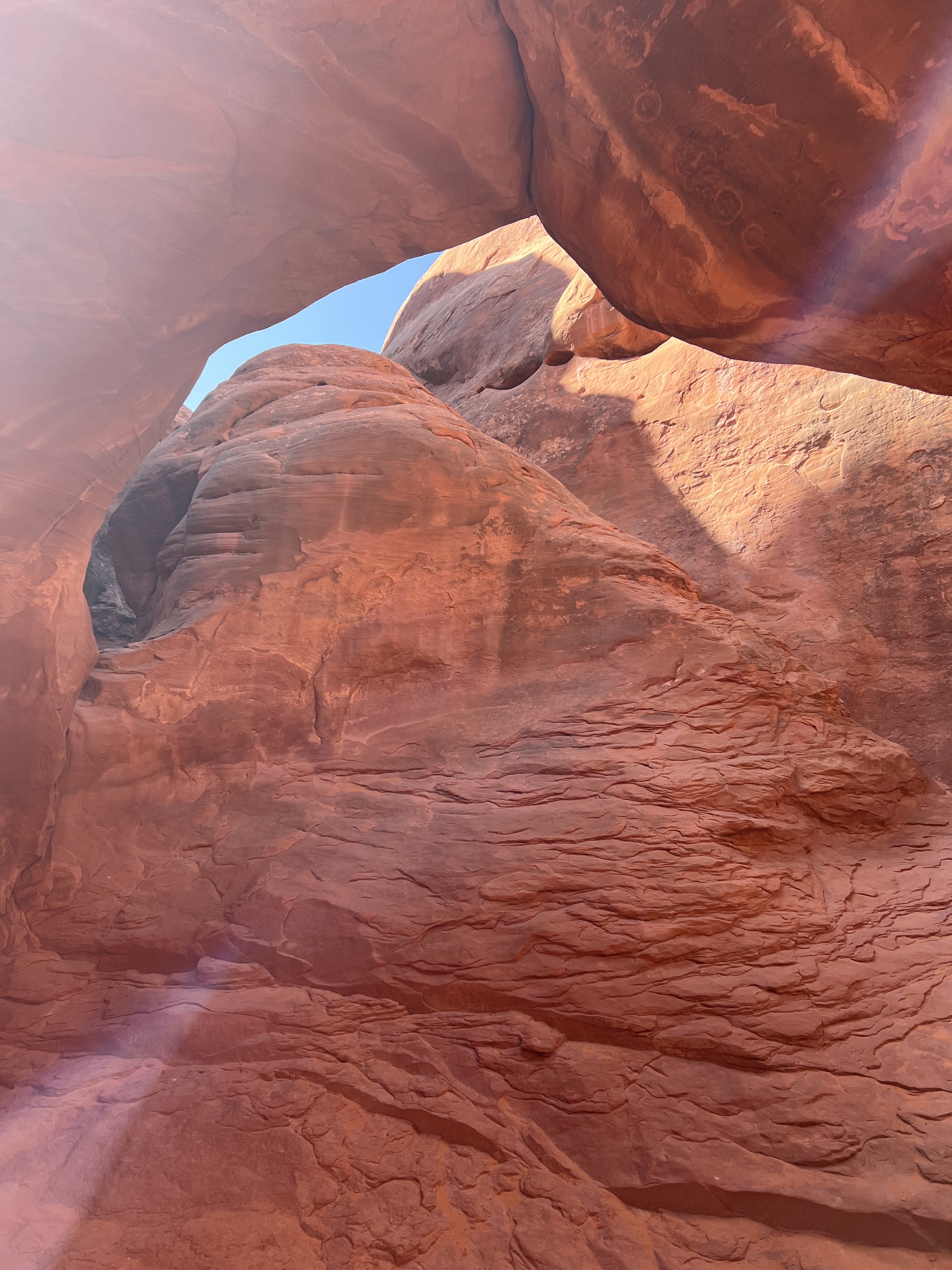
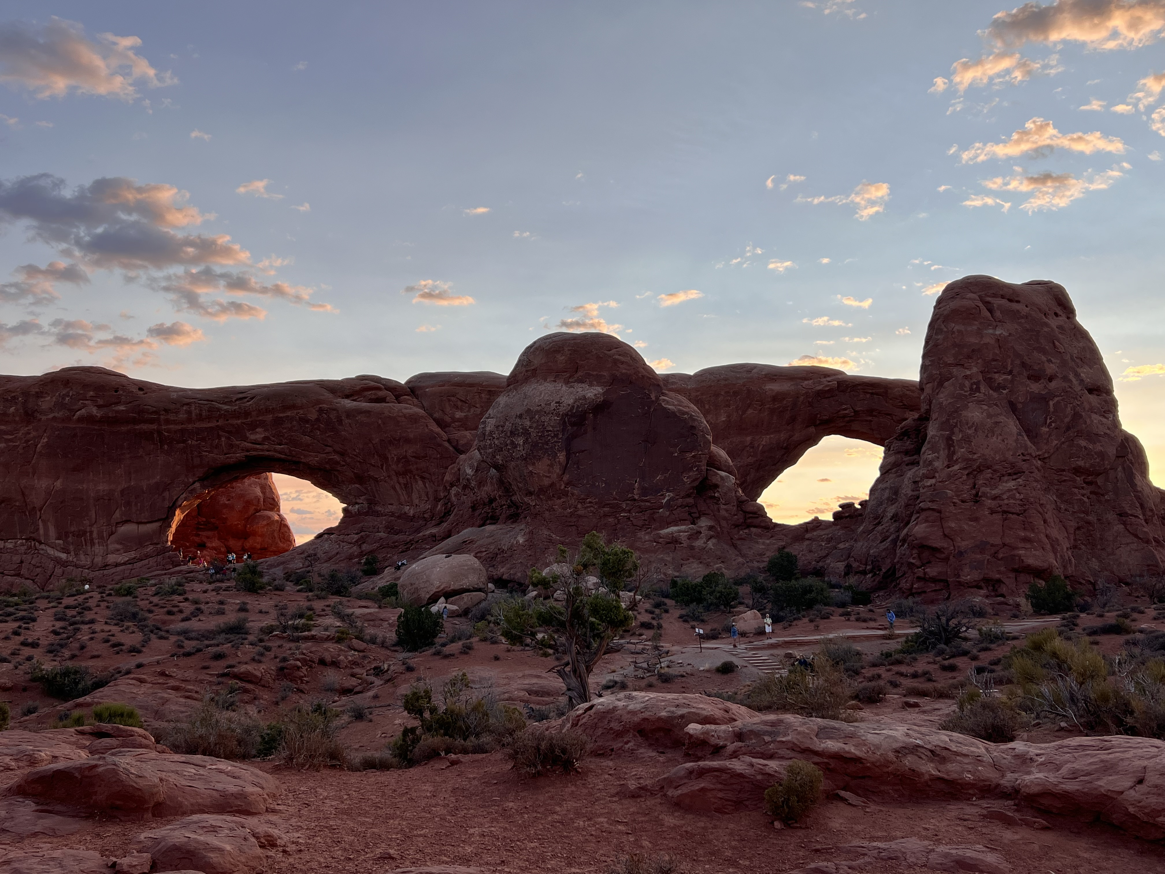
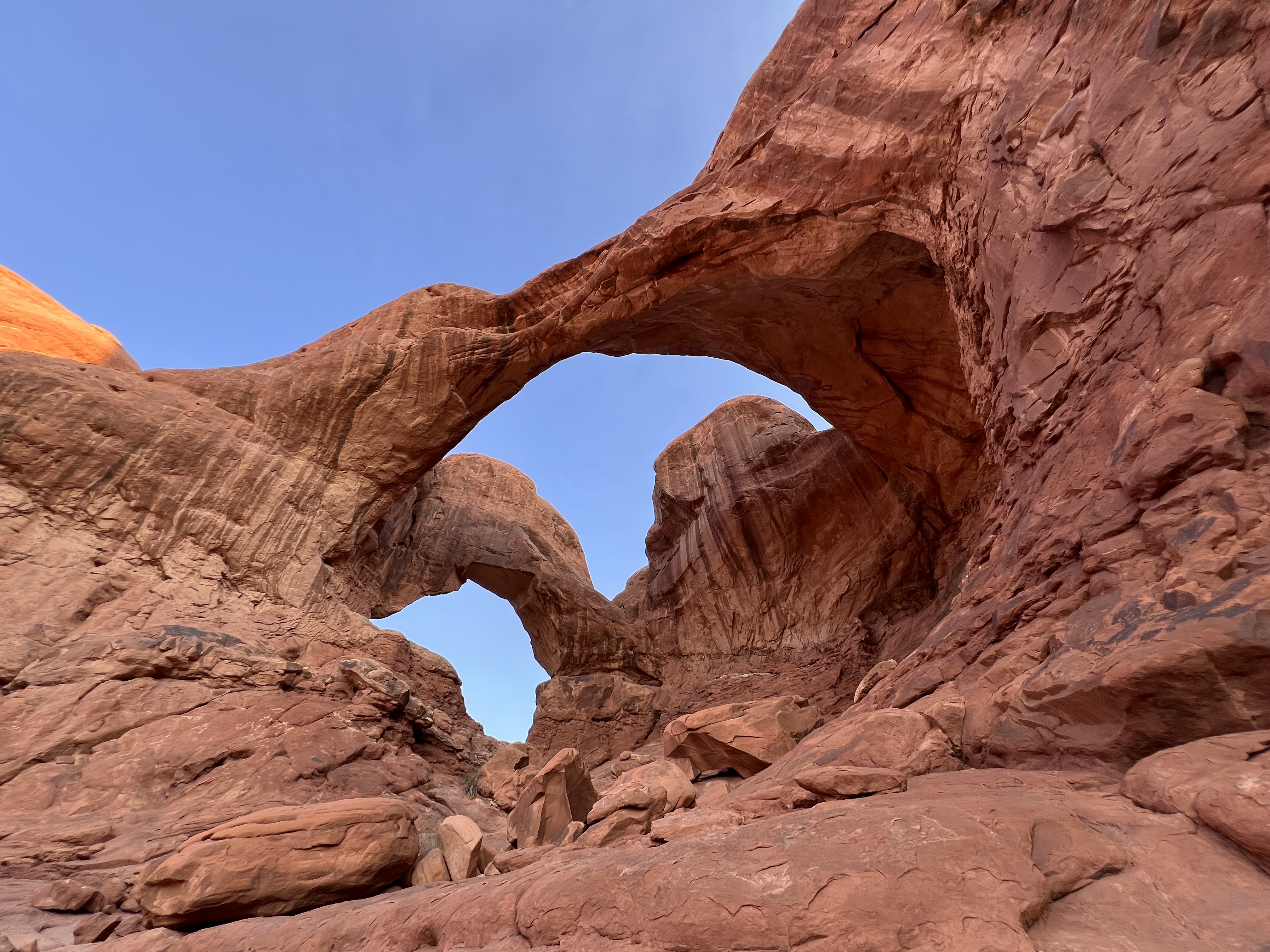
Arches National Park
The next morning, we headed out to Arches National Park, just a few miles northeast of Moab. Arches is one of the jewels of Utah, in fact of the whole country. It’s just spectacular. Our one-word description for Arches is “imperial.” It felt like we were driving through the crumbling ruins of some ancient imperial capitol except what’s crumbling are layer upon layer of rock.
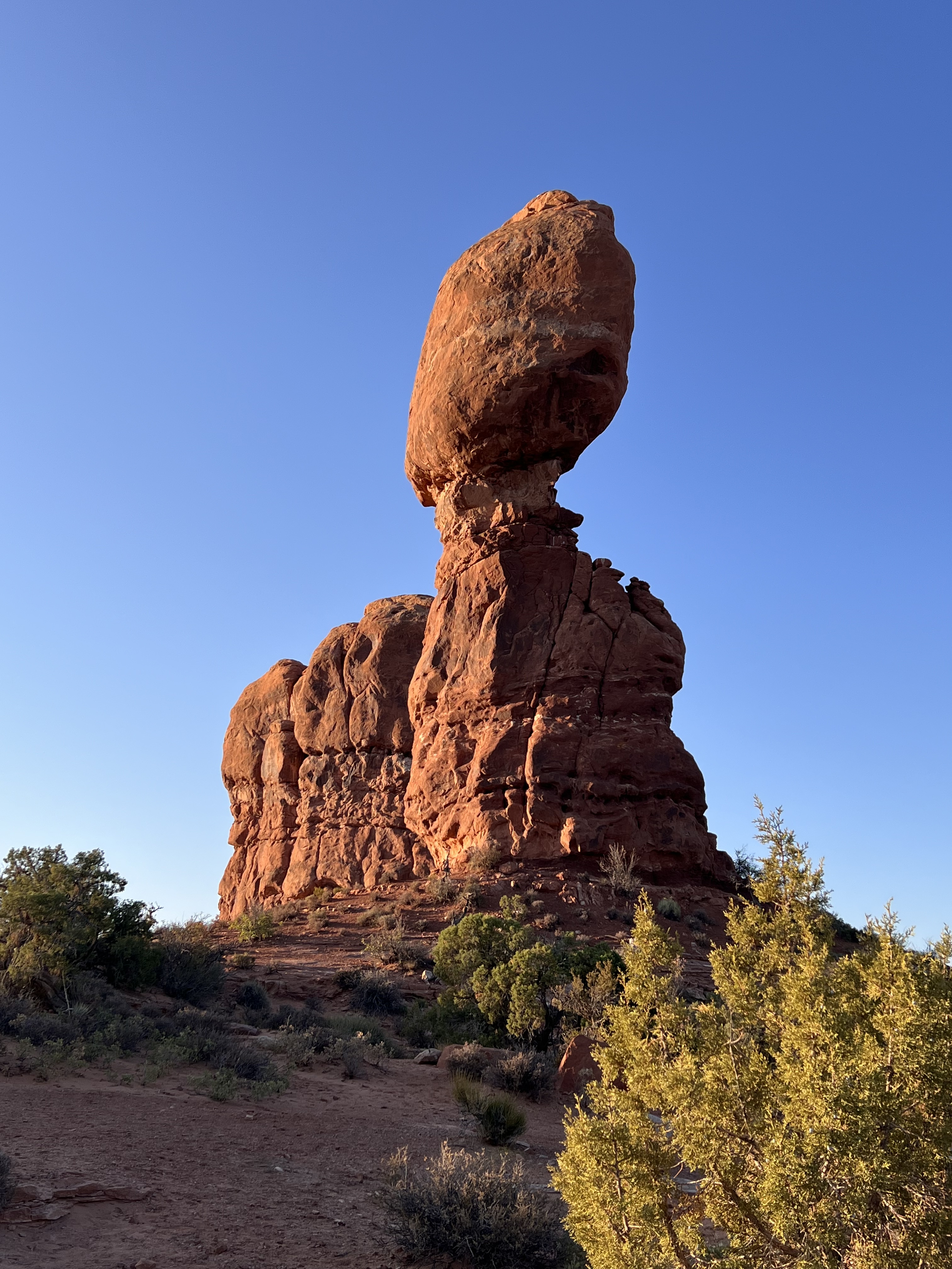
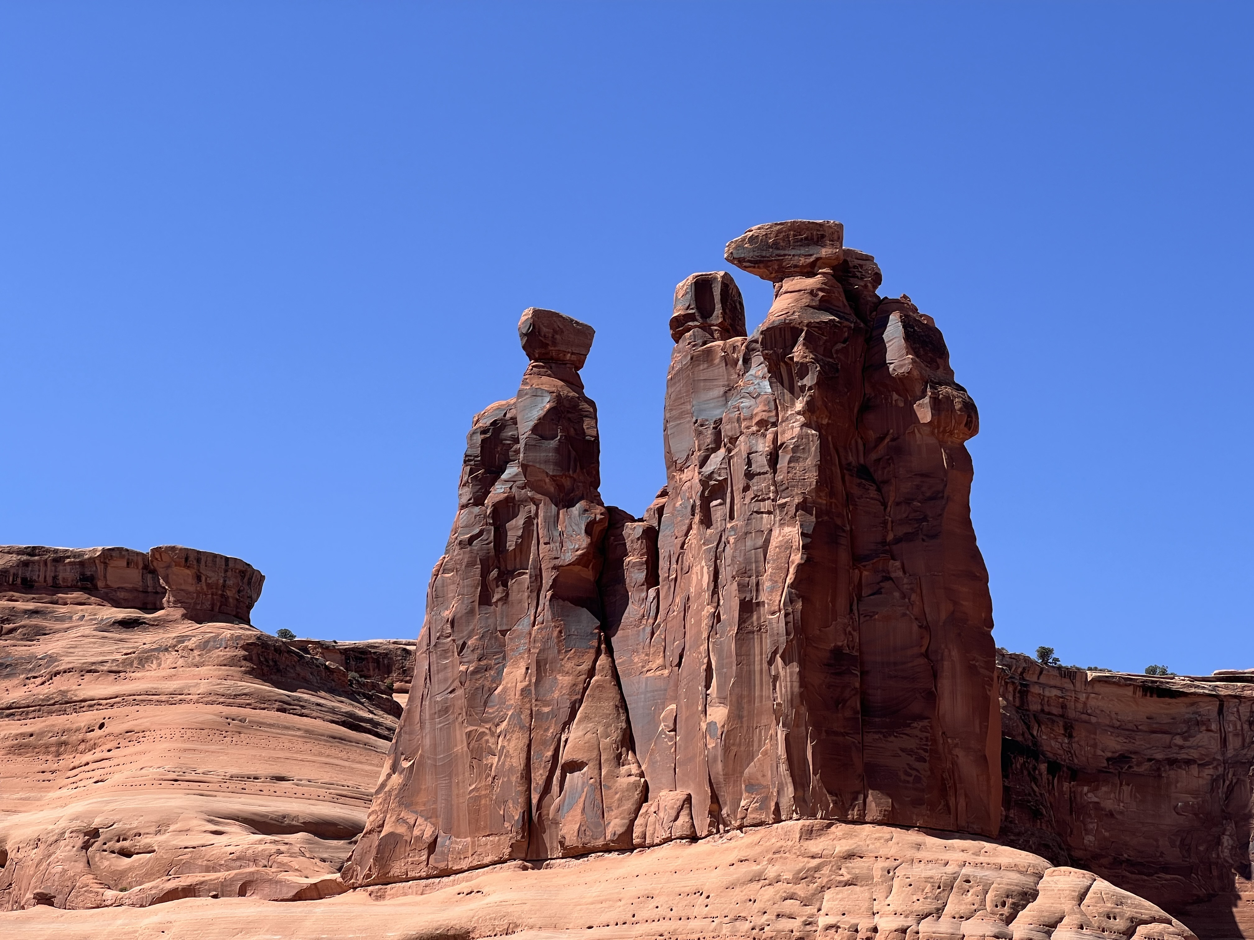
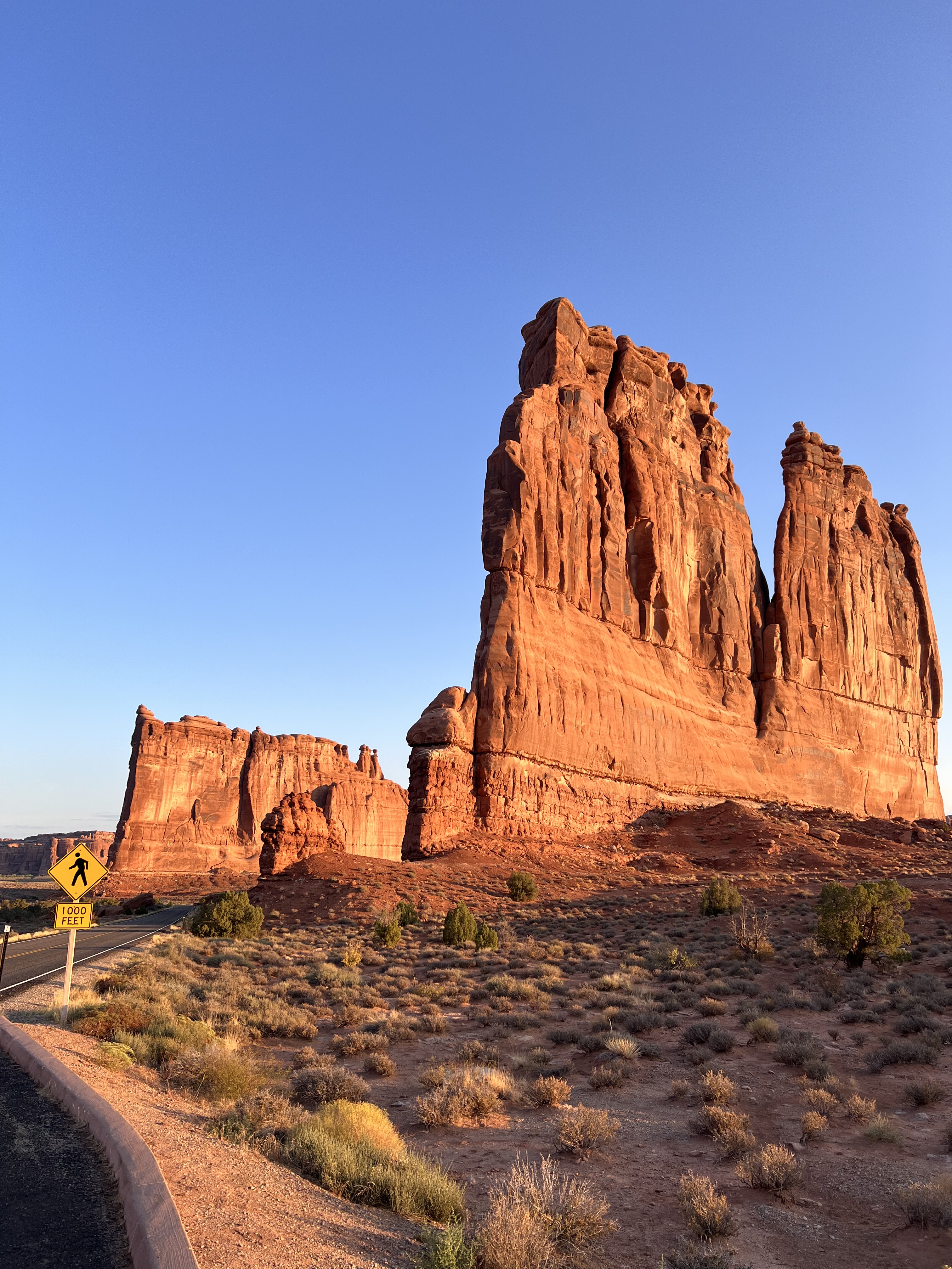
There are around 2500 arch formations in Arches National Park. Over the course of two days in the park, we saw less than 1% of them, but they were all amazing.
Utah 128, Castle Valley Road
After spending a second morning at Arches, we took a leisurely afternoon drive along Utah State Route 128, also known as Castle Valley Road or the Upper Colorado River Scenic Byway. It’s a beautiful 44-mile winding road that follows the Colorado River.
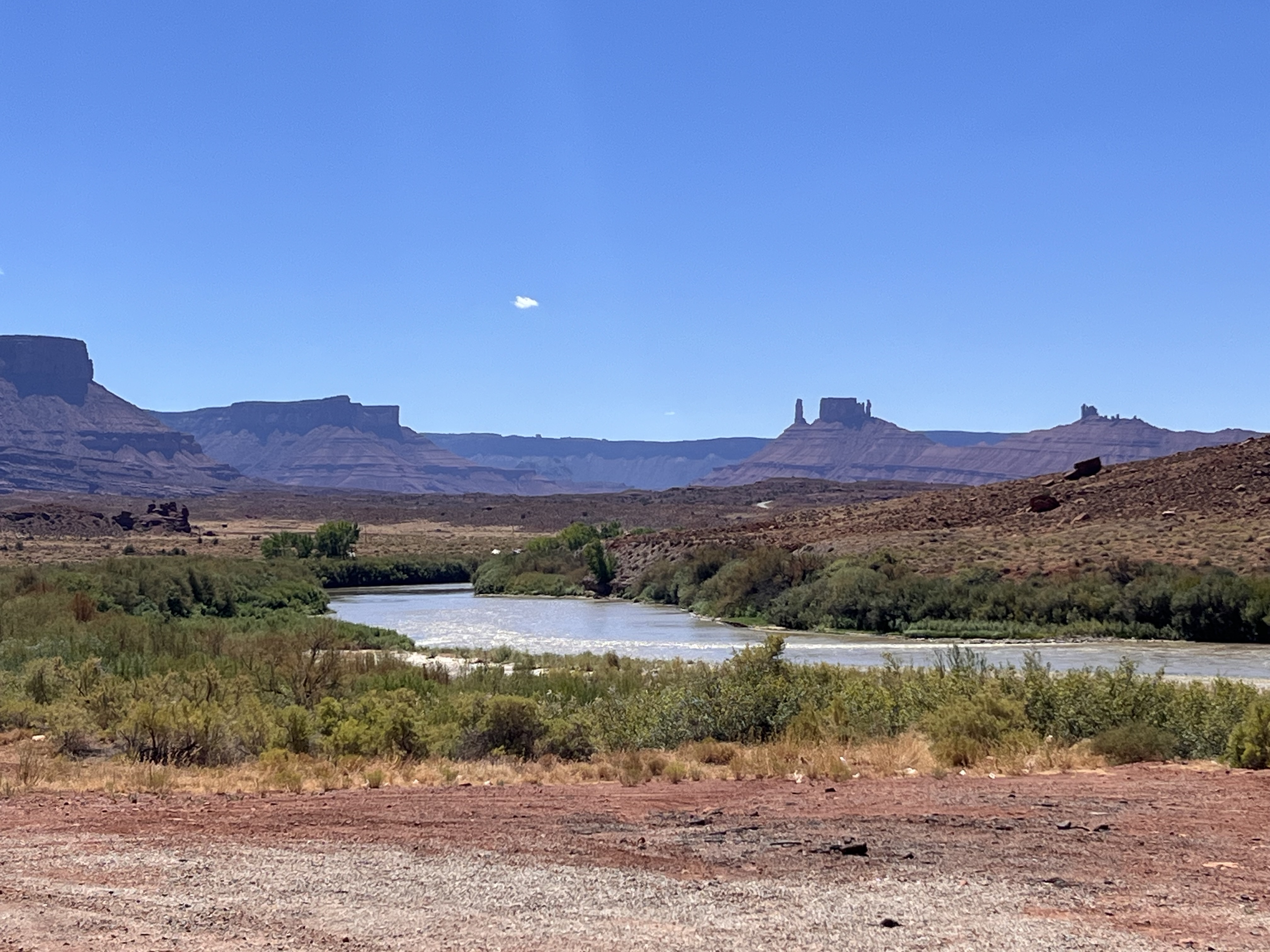
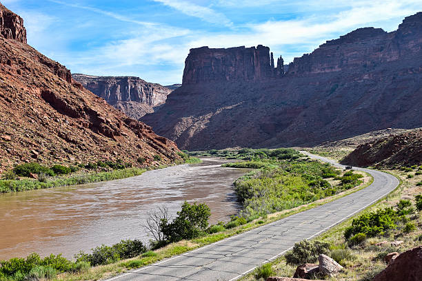
It’s not the Grand Canyon, but it certainly shows what the Colorado River can accomplish when you give it a hundred million years or so. Water always wins.
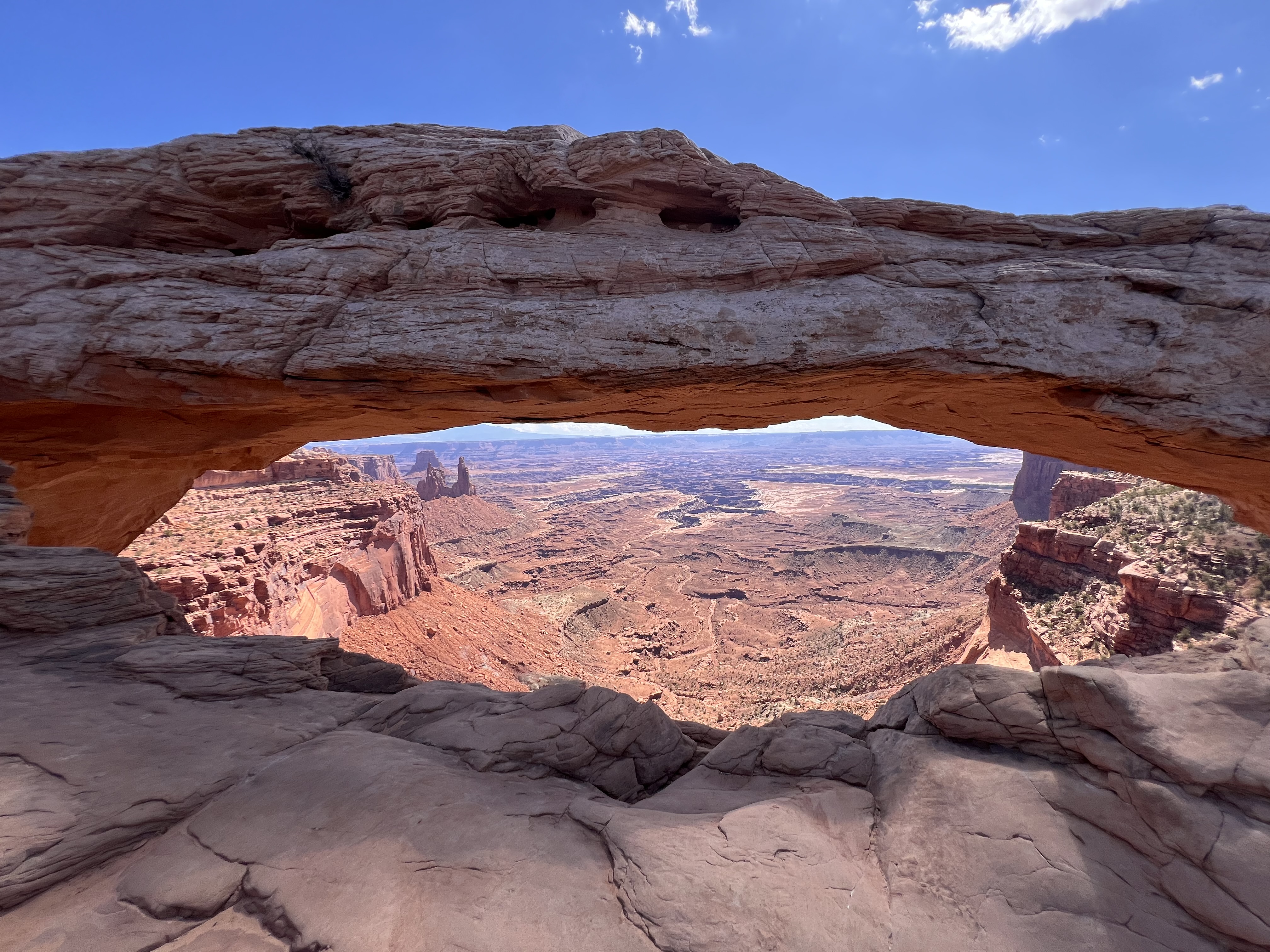
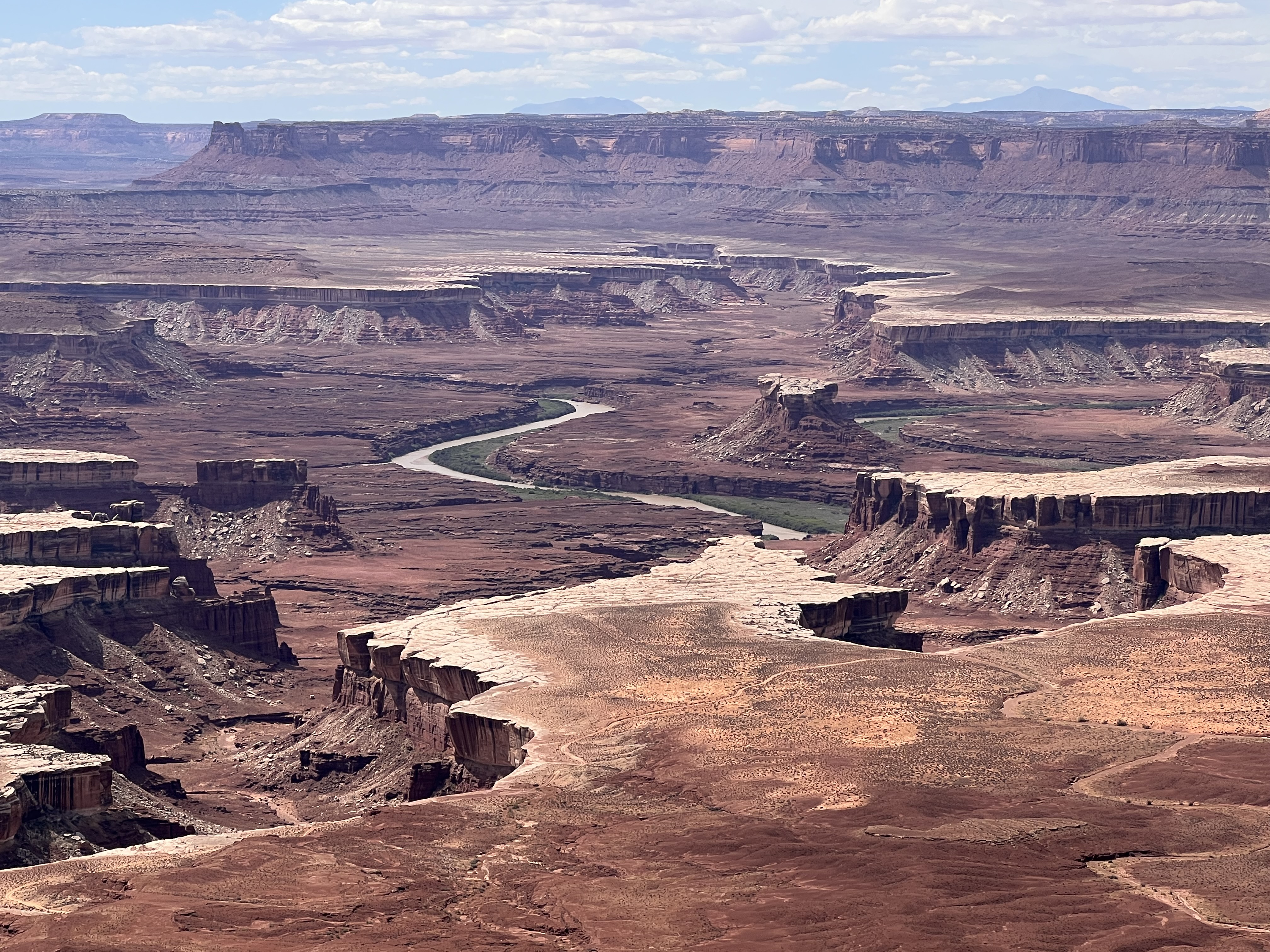
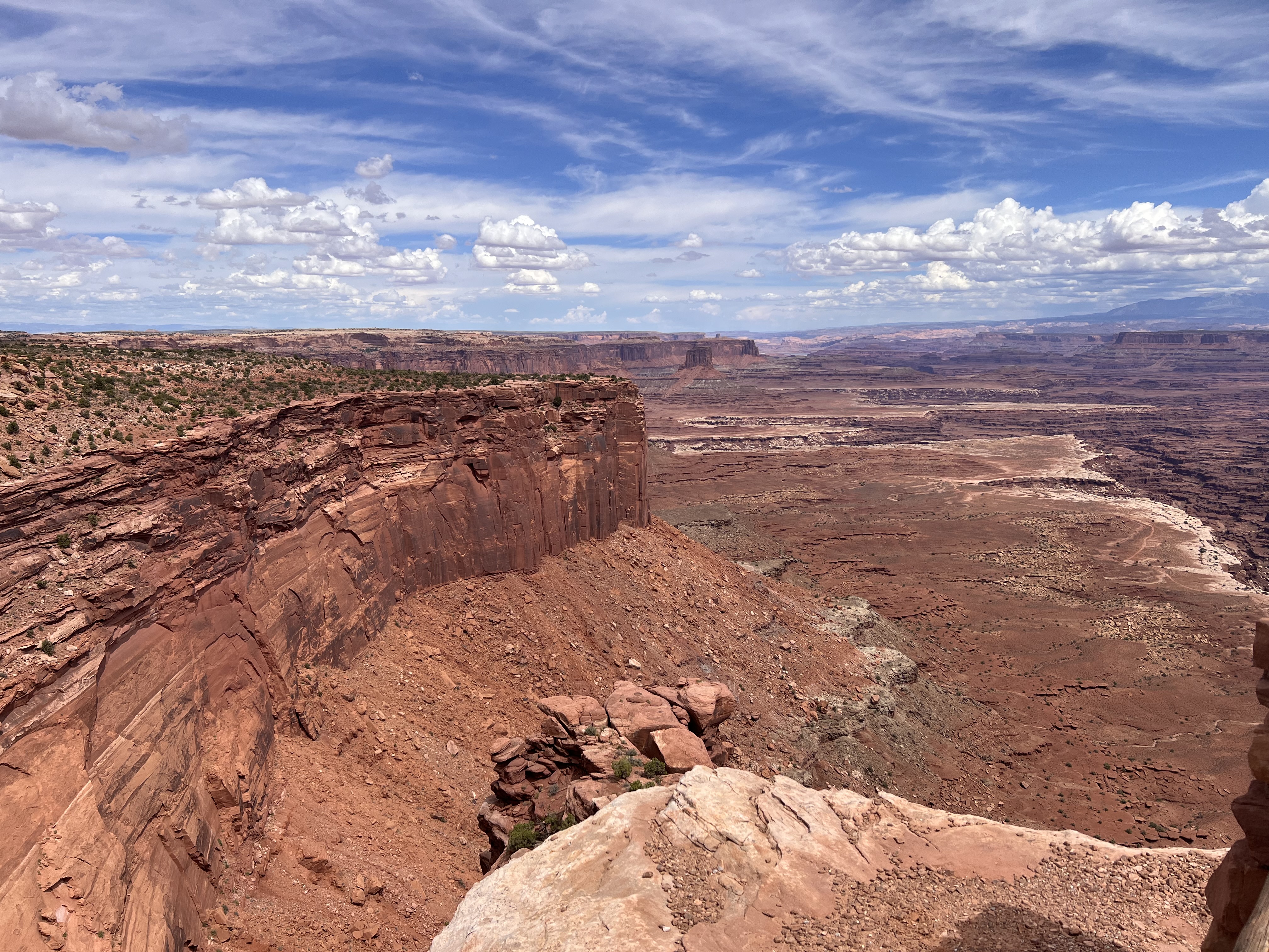
Canyonlands National Park
Next day we headed to Canyonlands National Park to the west of Moab. Canyonlands is divided into four “districts,” some of which are quite remote and require four-by-four vehicles to enter. We visited only the Island in the Sky district but it looks down on the other three. Here we listened to an excellent Ranger talk that gave us our basic grounding in geology.
Canyonlands is definitely one of those places where you’re at the top of a canyon looking down. You’re also looking into deep time: layers of rock dating back hundreds of millions of years. (Here’s a diagram showing the layers in detail.) Much of the erosion has been done by the Green and Colorado Rivers which meet at the south end of the park. Unfortunately, Grand View Point, the place where you can look down at the confluence of the two rivers, was closed for construction work while we were there. But we still got lots of impressive views. We called it “dramatic.”
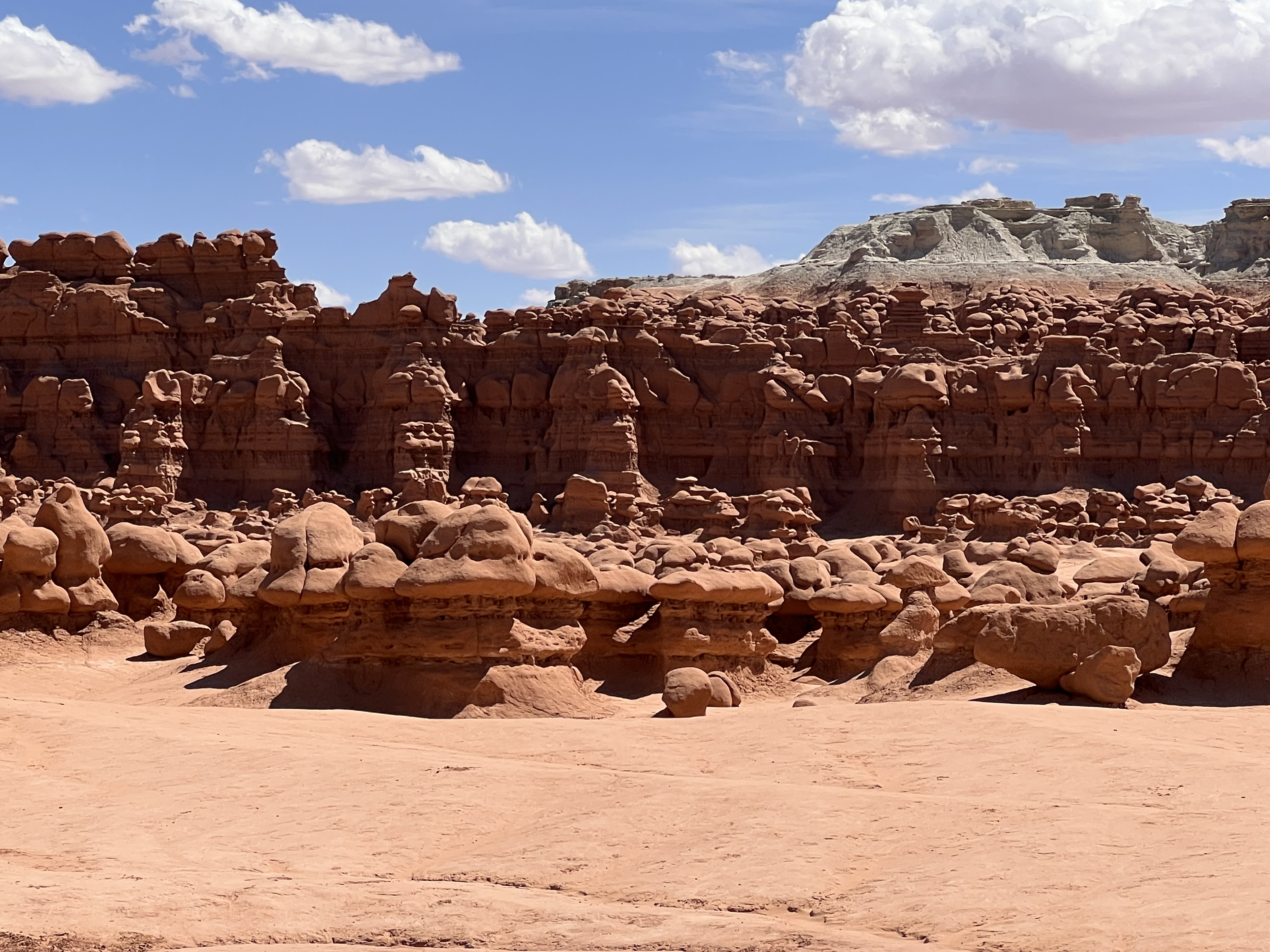
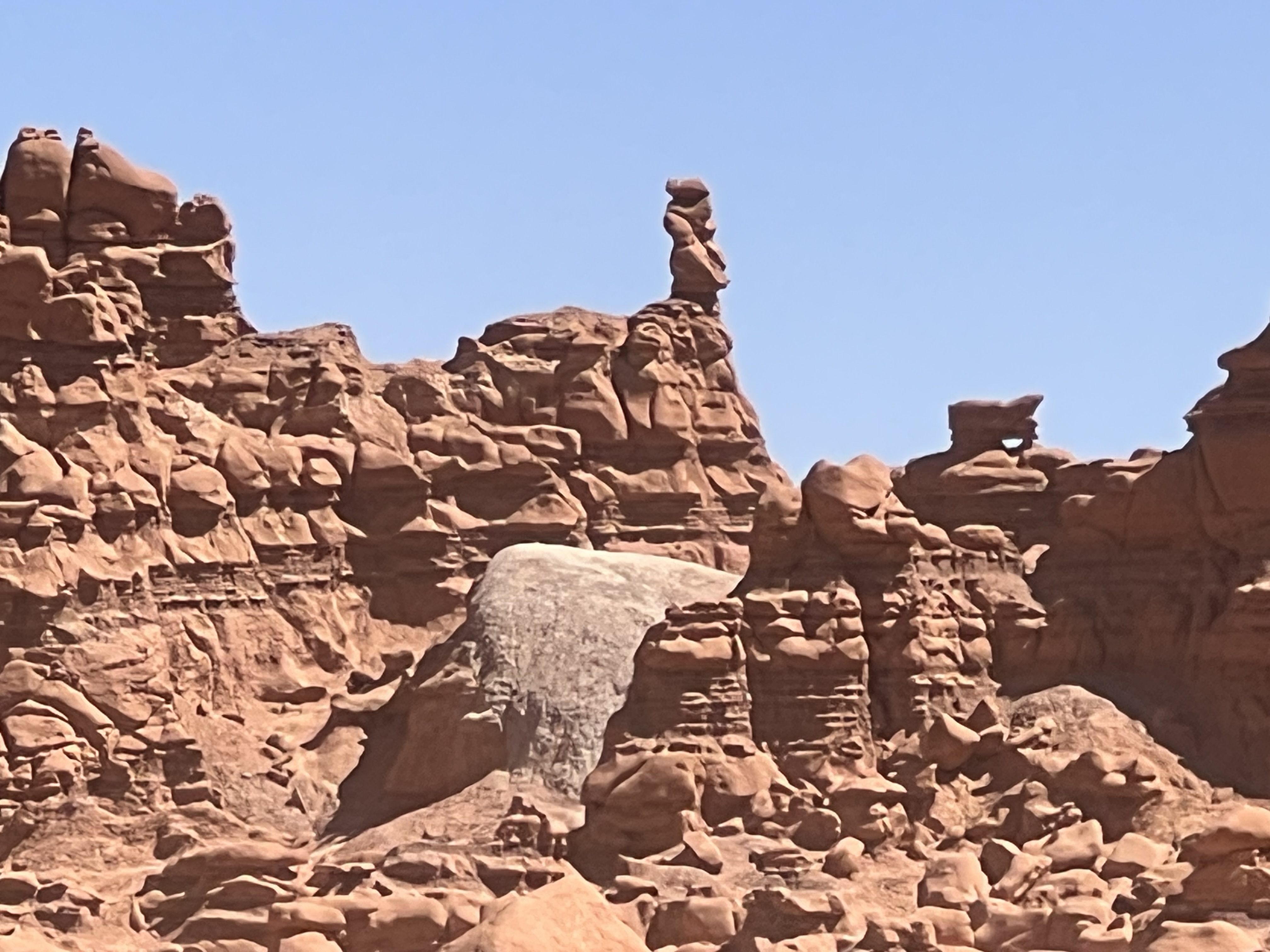
Here Be Hoodoos!
After four wonderful days in the Moab area, our next major stop was Capitol Reef National Park. Our route took us north from Moab to Interstate 70, west on I-70 and then south on Utah State Route 24. The Interstates rarely offer great scenery and this part of I-70 was no exception. After the red rocks around Moab, this drive took us through mostly flat, open, arid country covered with sagebrush.
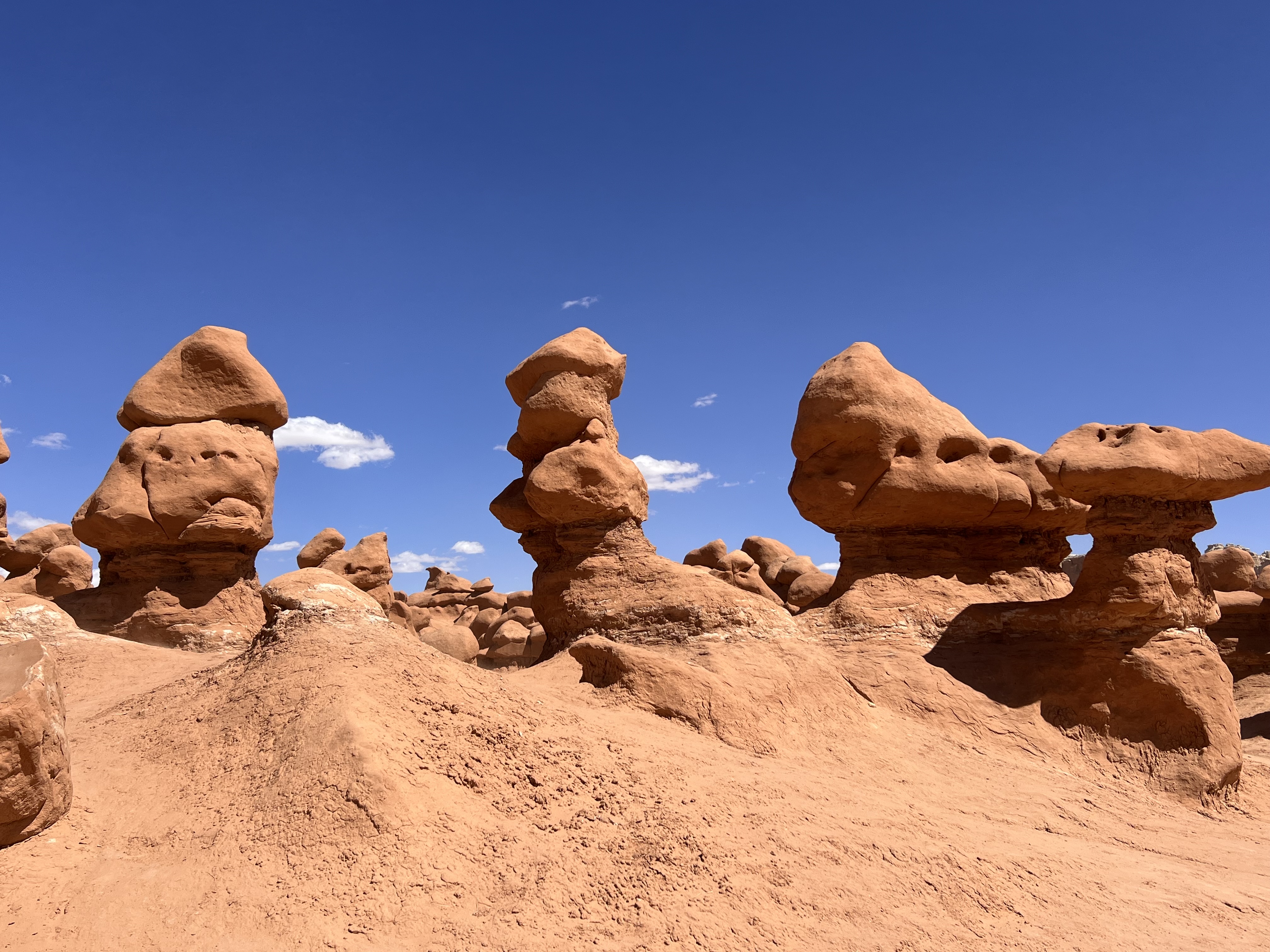
However, we stopped in at Goblin Valley State Park, just off Utah 24, to see the goblins, also known as “hoodoos.” Hoodoos are typically thin spires of rock created by erosion. The top of a hoodoo is usually a harder, more erosion-resistant rock than the softer rock that makes up the column. This often gives them a mushroom-like appearance.
Our one word for this spot was “whimsical.” I think you can see why.
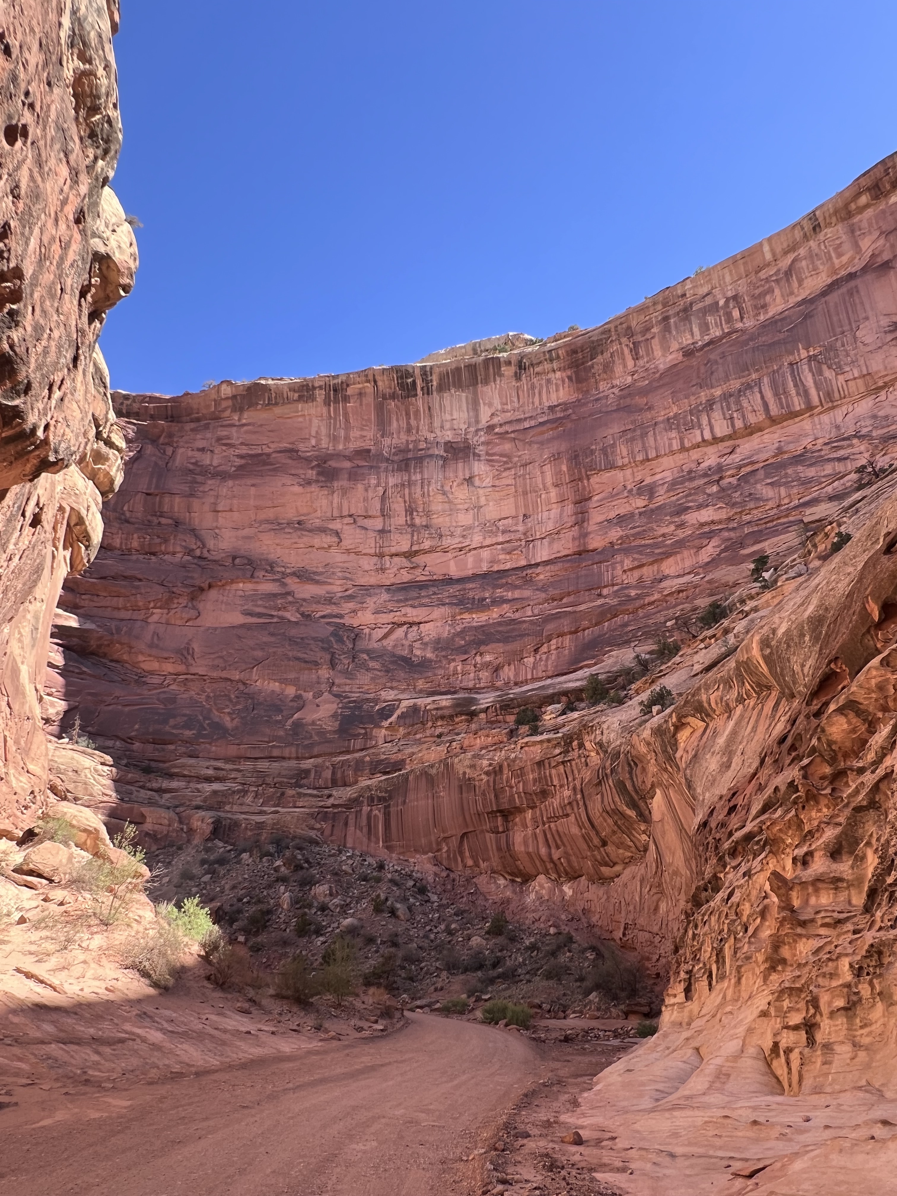
Capitol Reef National Park
Remember how I said the Colorado Plateau was uplifted as a single unit, with relatively few internal faults or folds? Well Capitol Reef is a giant exception. It’s part of a 100-mile long fold called the Waterpocket Fold that was thrust 7,000 feet higher than neighboring terrain about 50-70 million years ago. Erosion then took over, carving some fabulous cliffs and canyons.
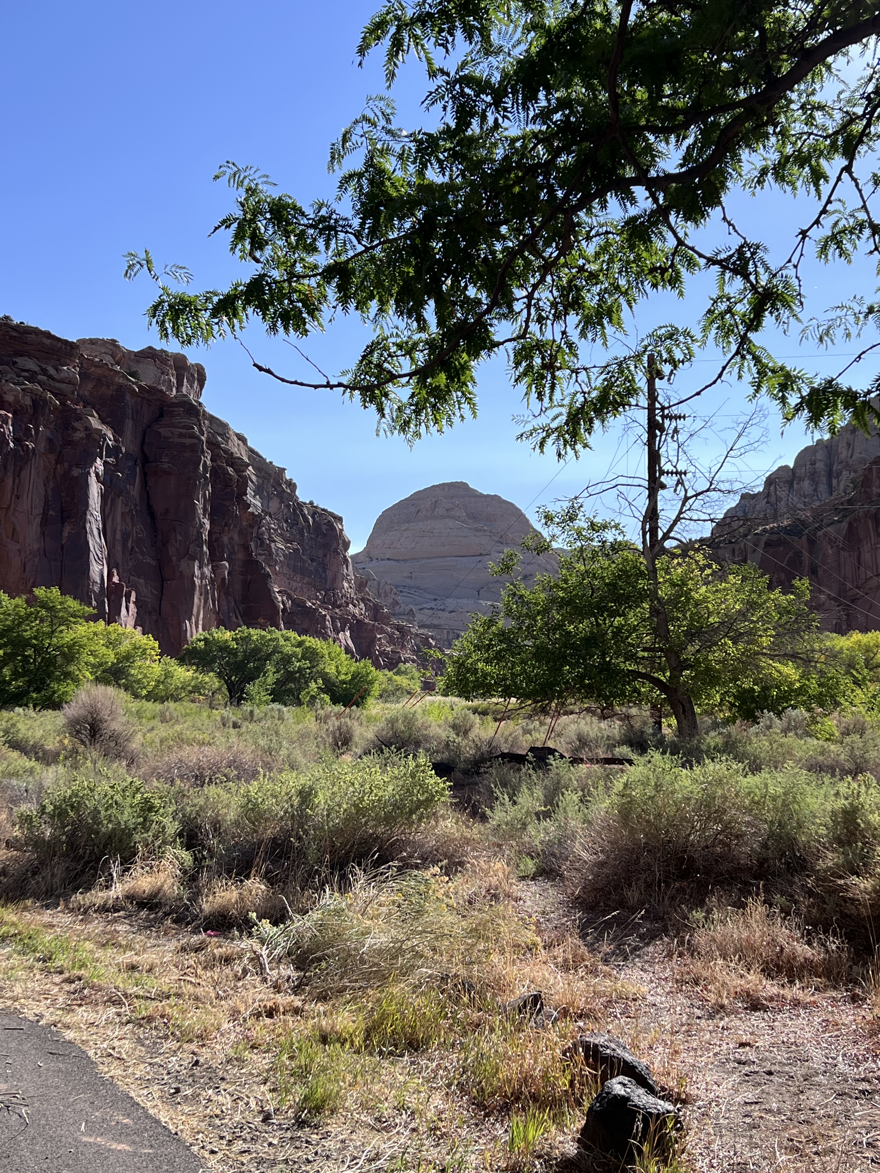
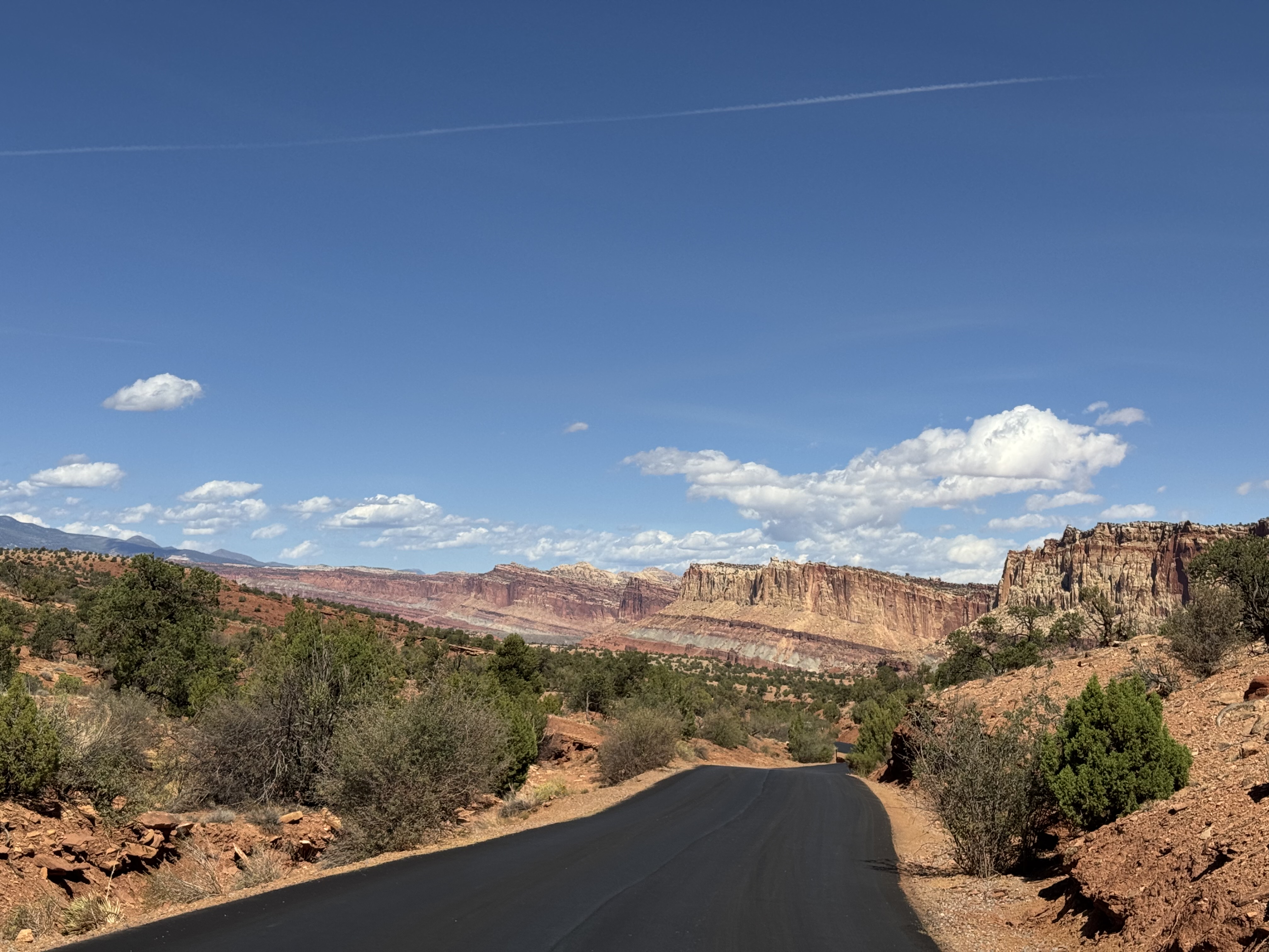
At the center of the park there’s a preserved historical settlement called Fruita. Settlers must have planted fruit trees a long time ago and they’re still producing and maintained by the National Park Service. At Gifford House you can buy delicious fruit pies made right there.
We stayed for two nights at Skyridge Inn, a lovely, traditional bed and breakfast located just west of the park in Torrey, Utah. Torrey is a tiny, rustic town strung out along a couple of miles of Utah 24. It’s home to several small hotels, restaurants and a general store. We grabbed dinner our first night there from the Capitol Burger food truck where they even offered Impossible burgers for us vegetarians!
A Note about Dark Skies
Many of the parks we visited, including Capitol Reef, are officially designated International Dark Sky Parks. These are places that work to preserve dark skies from the light pollution of modern cities. They’re fantastic places for stargazing and some offer organized stargazing tours. (A few years ago I read an interesting book called The End of Night that talks about these places and their importance in our culture.)
Unfortunately, our trip coincided with the days before and after the full moon, and on several nights the skies were partly cloudy. So we didn’t get to see as much of the night sky as we’d hoped. Still we did try a few experiments with nighttime photography using our iPhones.
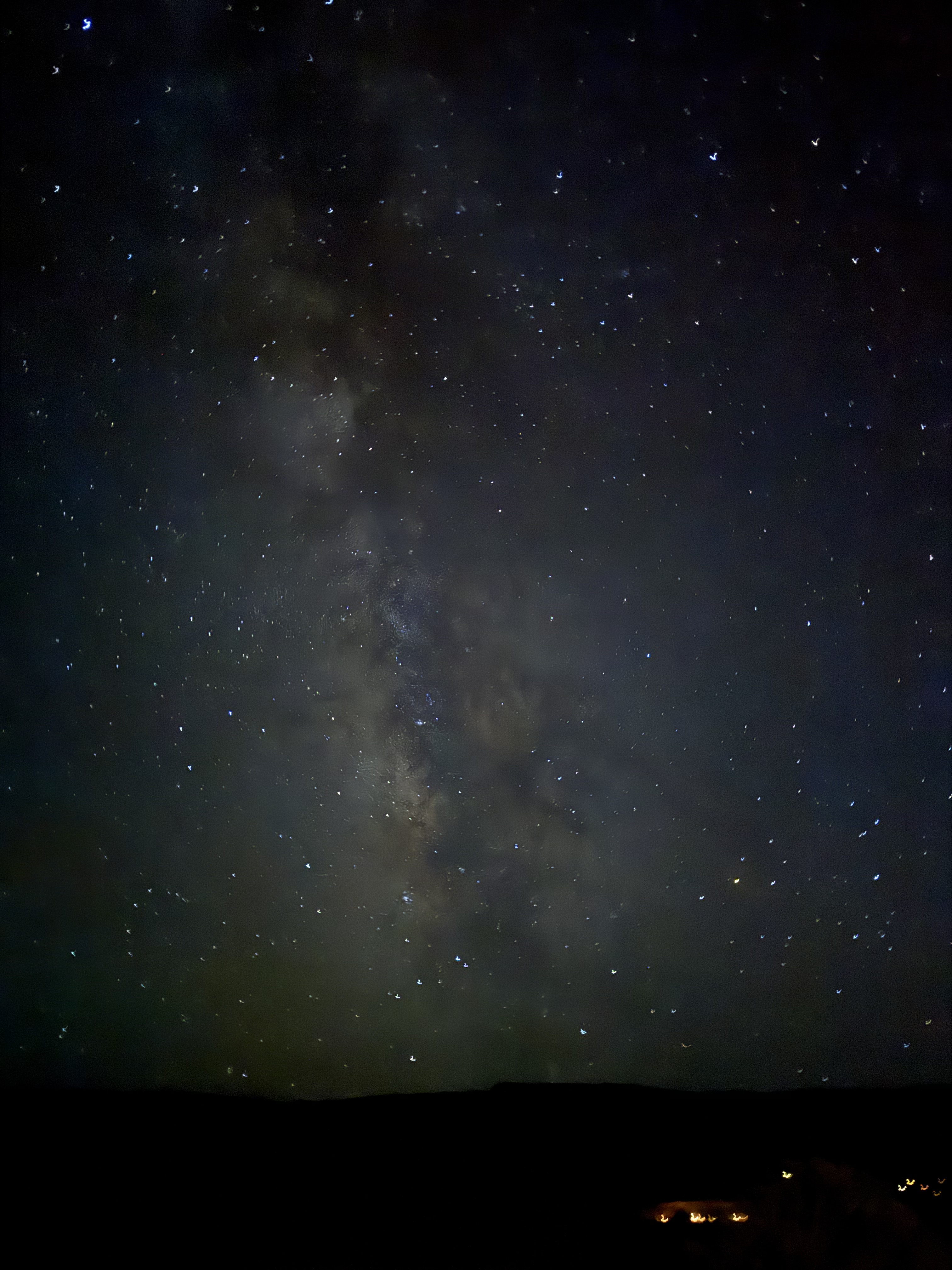
By the way, neither of us are professional photographers. All our photos were taken on iPhones.
Pando Aspen Clone
On our second day at Capitol Reef, we made a side trip to see the Pando Aspen Clone. It’s a forest of about 40,000 quaking aspen trees covering over 100 acres, all connected by a single root system, originating from a single seed. It’s really one giant organism. In fact it’s believed to be largest single organism in the world. It’s also one of the oldest, likely having germinated at the end of the last ice age.
The elevation at Pando is over 9000 feet and our rental car had to work hard to climb the mountain slopes. The forest itself is beautiful and it’s amazing to think of all those trees as part of the same organism. But there’s not much there in terms of information or even signage.
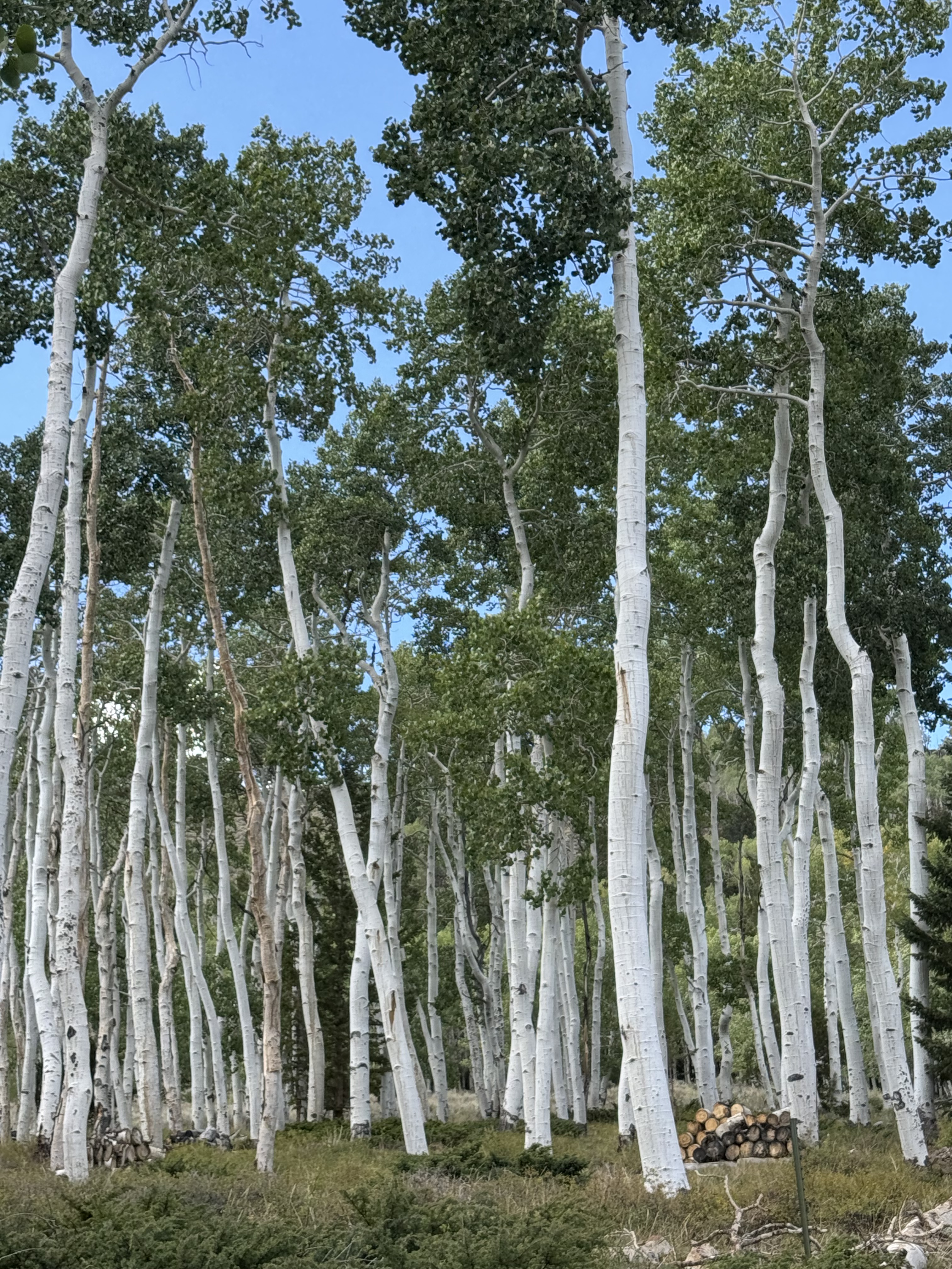
Unfortunately, Pando is dying, a victim of over-grazing by elk, mule deer and free-ranging cattle which eat the new stems. Humans eliminated wolves from the area about 100 years ago so there’s no apex predator to keep the elk and deer population under control. Now major sections of Pando are fenced off to protect the trees. I hope it works.
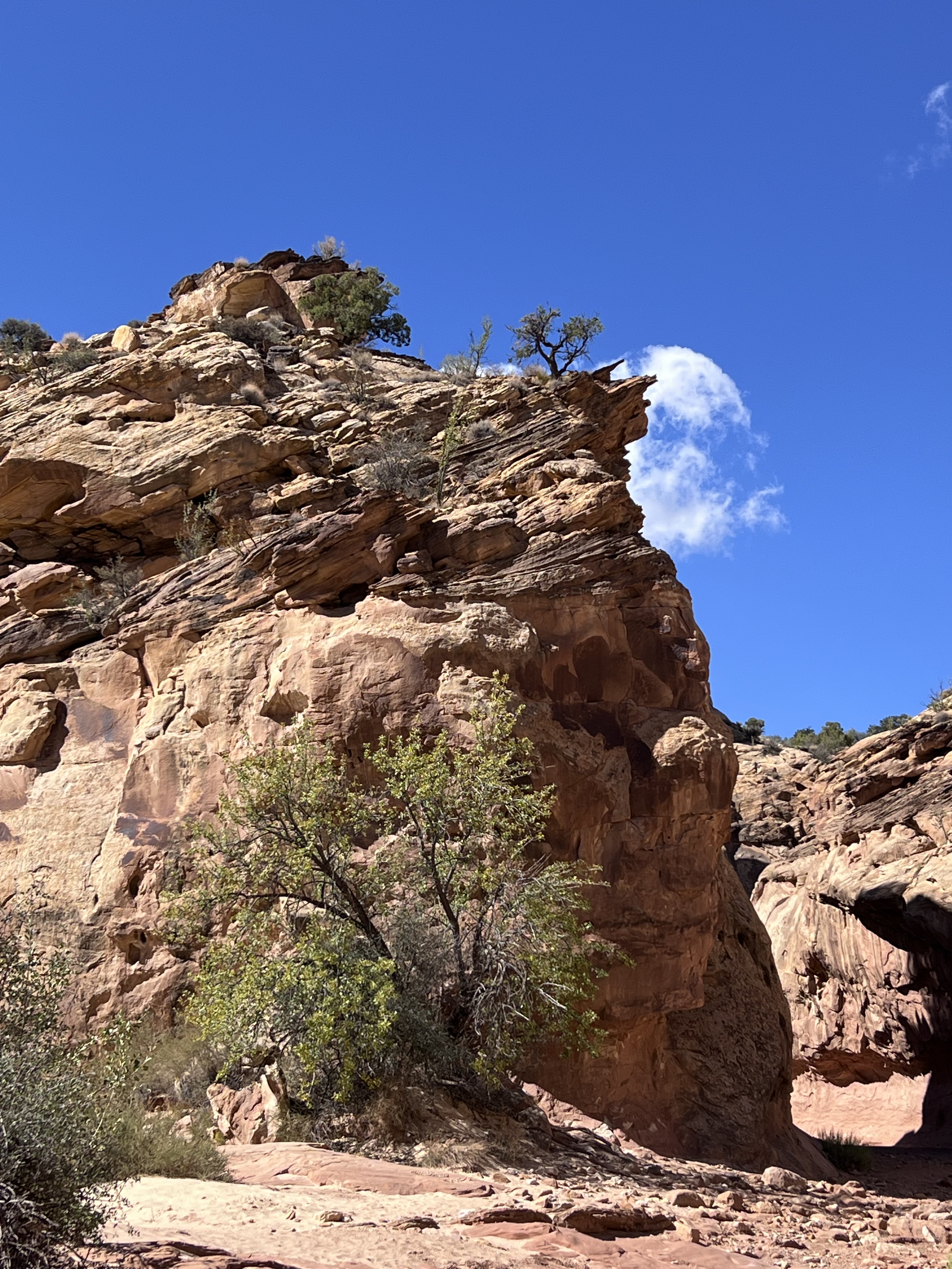
Escalante Petrified Forest State Park
In the morning, we took Utah State Route 12 south out of Torrey towards Bryce Canyon, our next major stop. Utah 12 is a designated “All American Road” also known as Scenic Byway 12 and “A Journey Through Time Scenic Byway.” Bit of a mouthful, but it is a very beautiful drive. The road summits at nearly 10,000 feet giving a stunning view of the surrounding countryside.
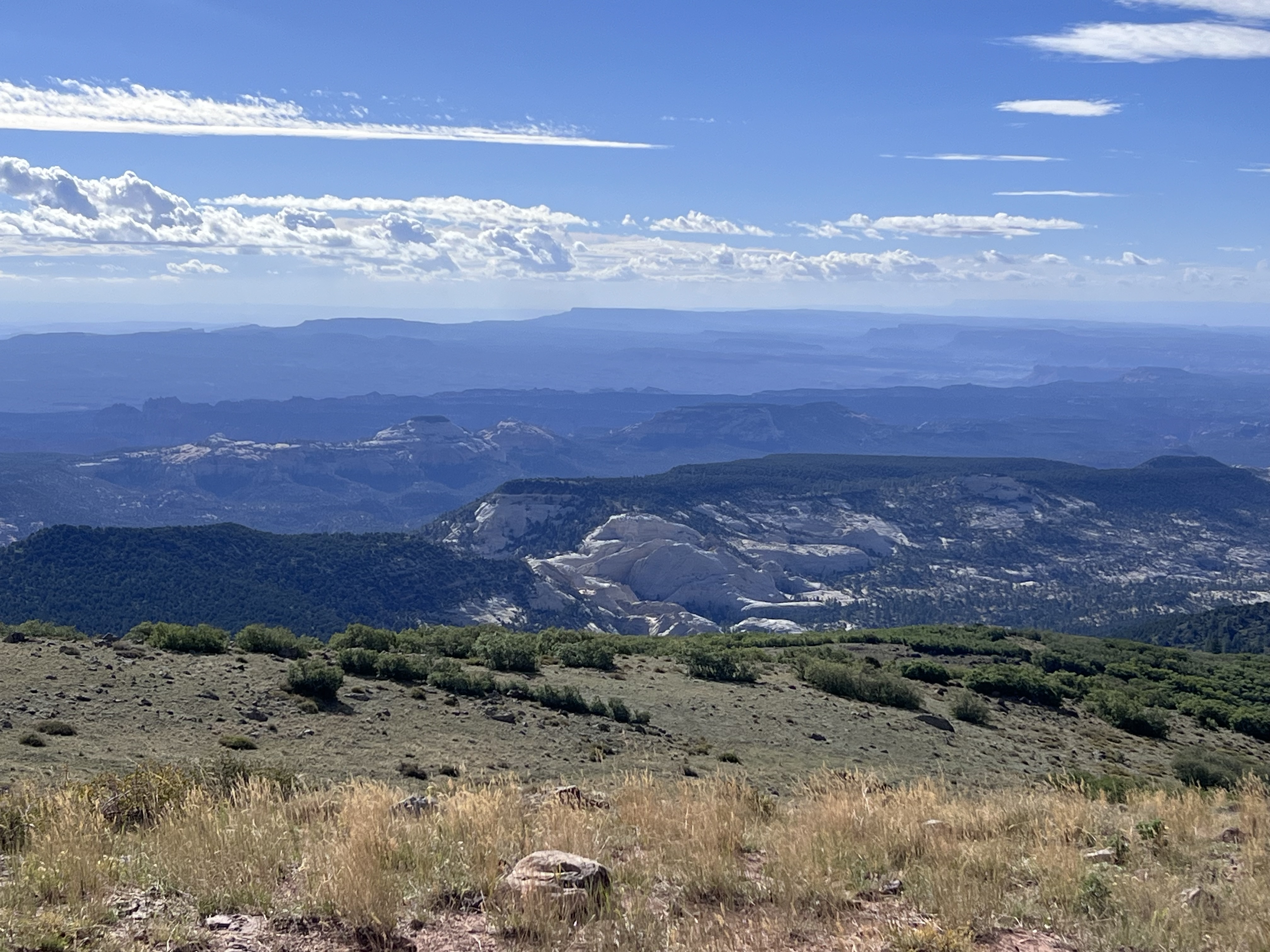
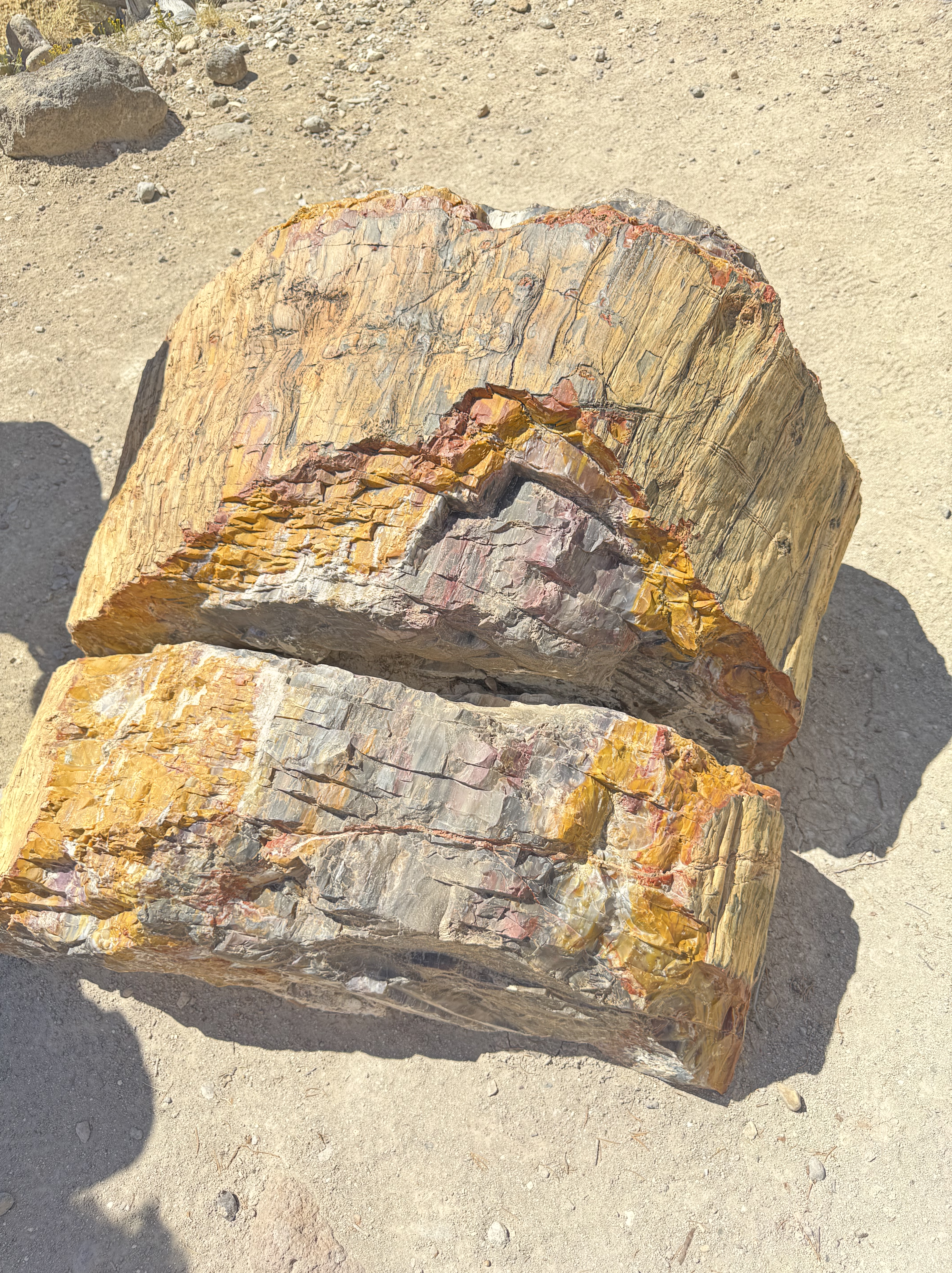
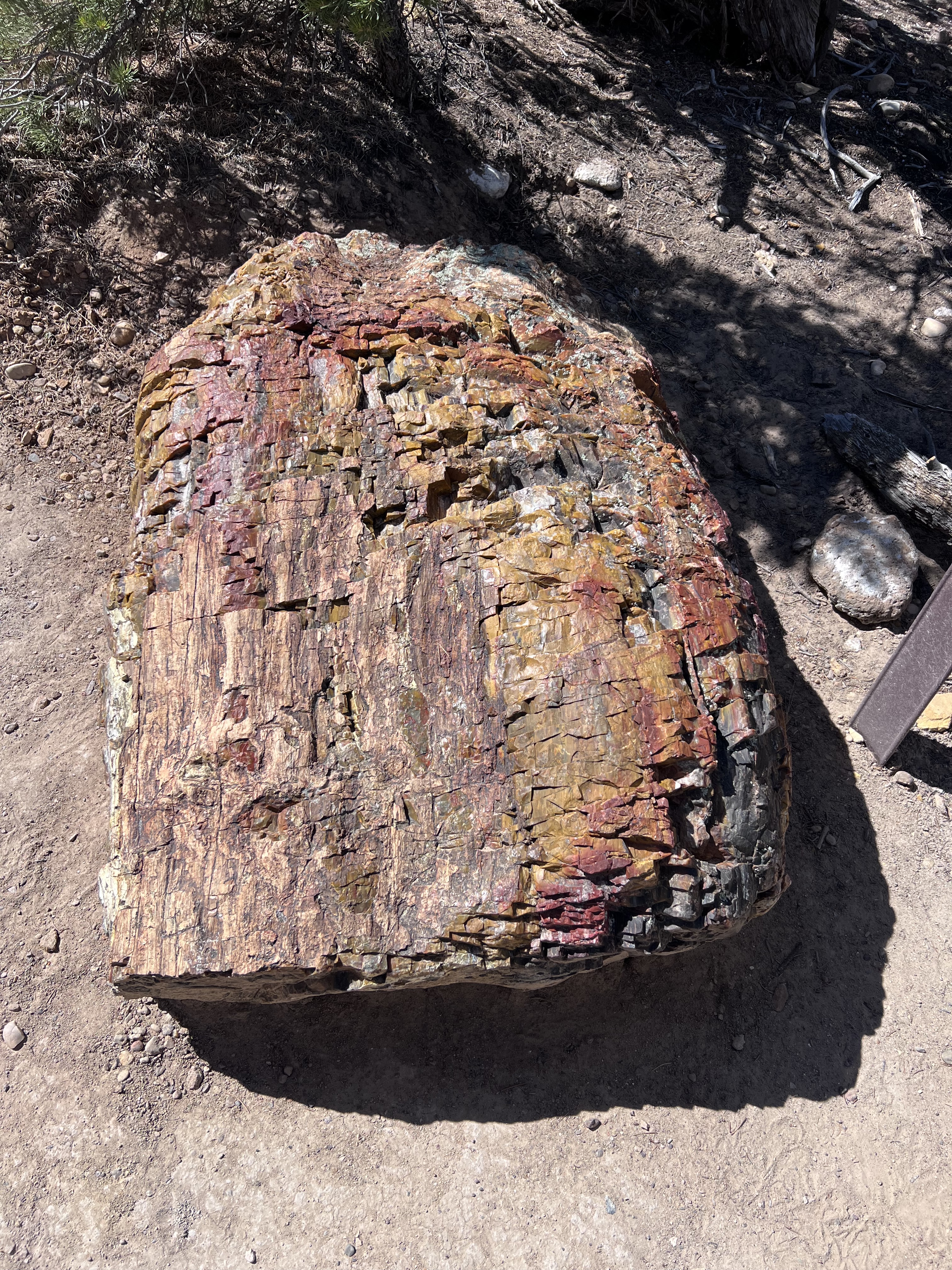
We pulled off at Escalante Petrified Forest State Park for a brief but steep bit of hiking to see the remains of colorful petrified wood scattered about the area.
As we continued on along Utah 12 we passed through the northern end of Grand Staircase-Escalante National Monument, but we didn’t have time to stop, alas. The Grand Staircase refers to stepped layers of sedimentary rock that stretch all the way down to the Grand Canyon.
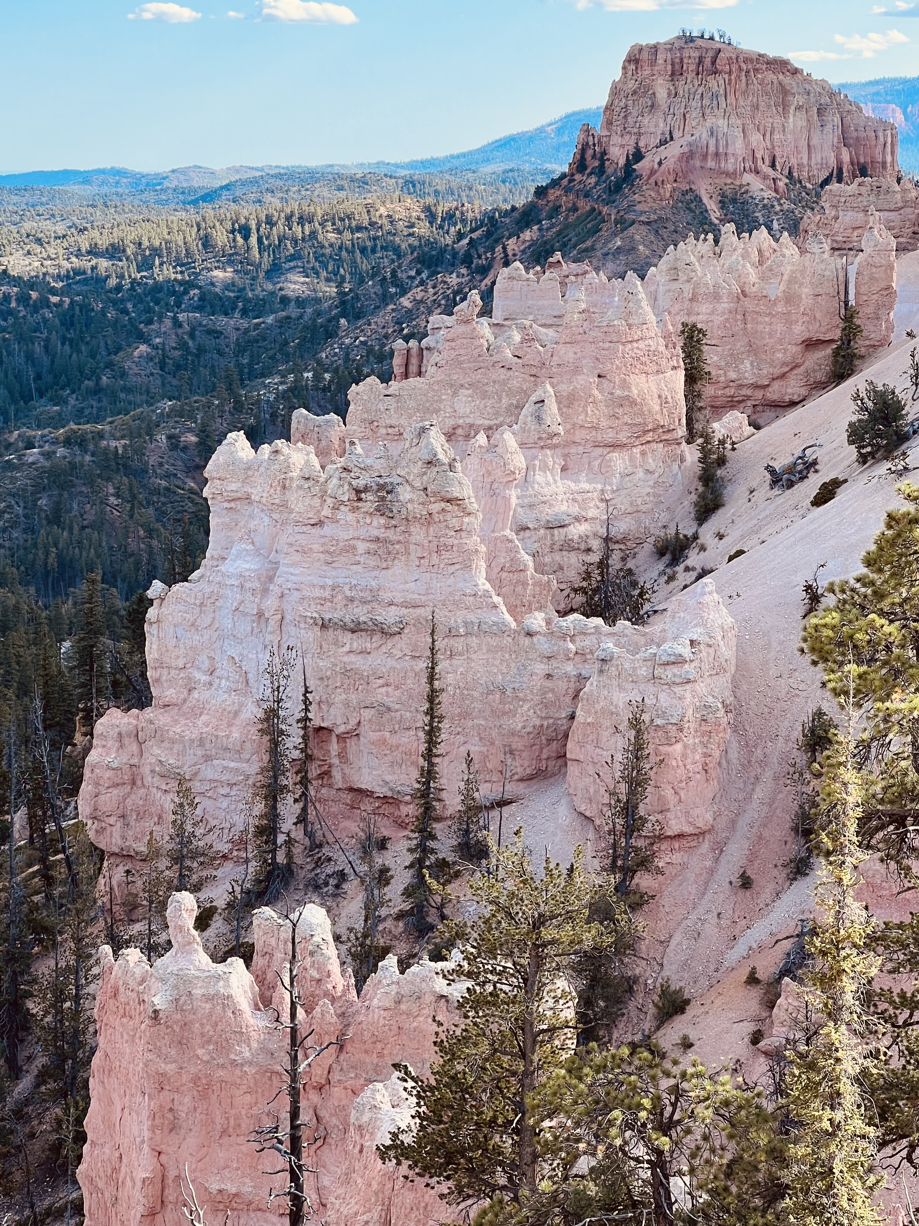
Bryce Canyon National Park
We continued along Utah 12 to Bryce Canyon National Park.
Technically, Bryce Canyon isn’t a canyon at all. Instead, it’s an 18-mile-long cliff face along the edge of the Paunsaugunt Plateau that’s been sculpted and eroded into amazing rock formations. Bryce has the world’s largest collection of hoodoos.
Bryce is one of those places where you’re at the top of the canyon, or cliff in this case, looking down. For adventurous folks, there are some hikes you can take to lower levels.
Bryce Canyon defies photography. Everywhere you look, everywhere you point your camera, there’s something astonishing, stunning or spectacular to see. Yet no photograph can possibly do it justice. Bryce refuses to be confined in a frame. All you can do is take your photos and hope to capture small fragments of its indescribable beauty.
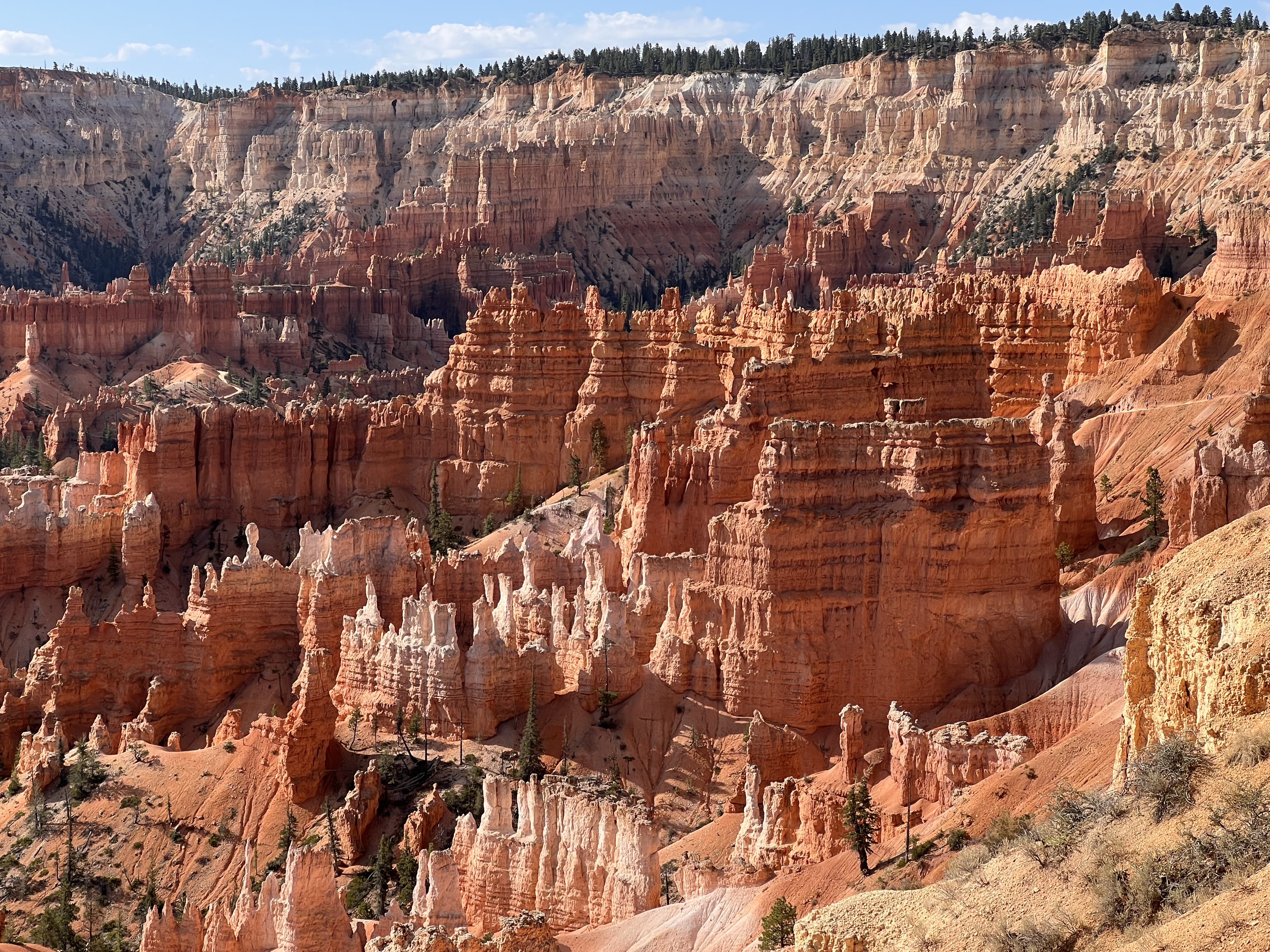
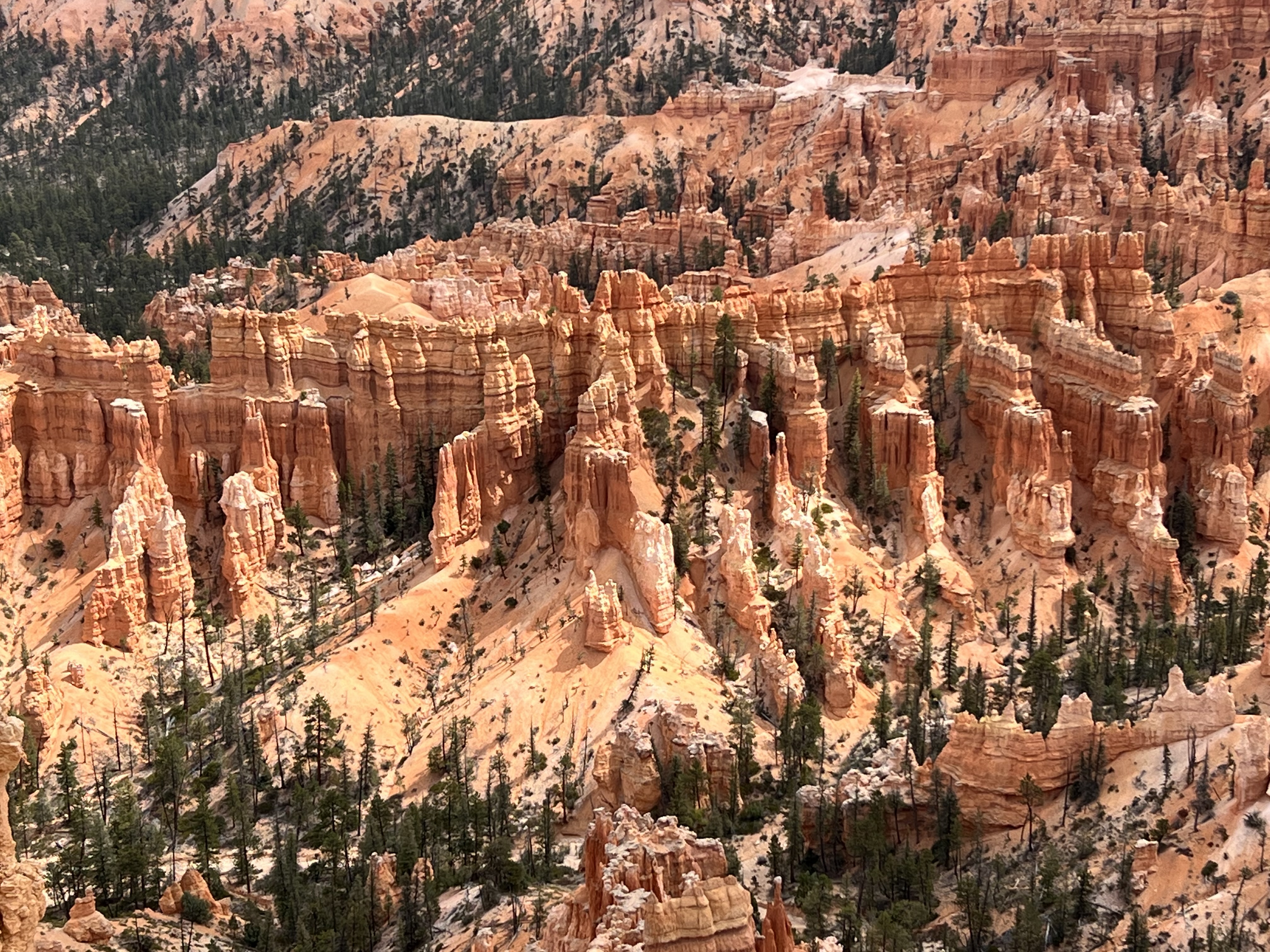
We had trouble coming up with a one-word description of Bryce, eventually settling on “magical.”
Zion National Park
We drove from Bryce Canyon to Zion National Park along US Route 89, turning onto Utah State Route 9 at Mt. Carmel Junction. It’s a lovely scenic drive, especially the part along Utah 9: a very twisty road that roughly follows Pine Creek until it meets the Virgin River which flows north/south through the main body of the park. We also drove through the 1.1-mile-long Zion-Mount Carmel Tunnel. I’m not generally claustrophobic, but I admit that drive was a little unnerving, and I wasn’t even doing the driving!
Passenger vehicles are not permitted in most of Zion. Instead there’s a free shuttle bus that takes you to various stops in the park, and another bus that takes you from the nearby town of Springdale to and from the park. This is a good thing because the park was mobbed. Even though we arrived at the Visitor’s Center by about 9:00 am, the parking lot was completely full. We had to park just outside the gates in a private parking lot for the extortionate price of $40/day.
Still, if they didn’t ban cars from the park, the traffic and the pollution would be unbearable. If we were to go again, we’d rent bicycles which you can do at several of the local hotels and tourist shops. This would have given us mobility without having to line up for, and ride in, crowded shuttle busses.
I suspect the reason Zion is so crowded is that it’s just a 2.5 hour drive from Las Vegas, so it’s easy to do an overnight or even a day trip back and forth.
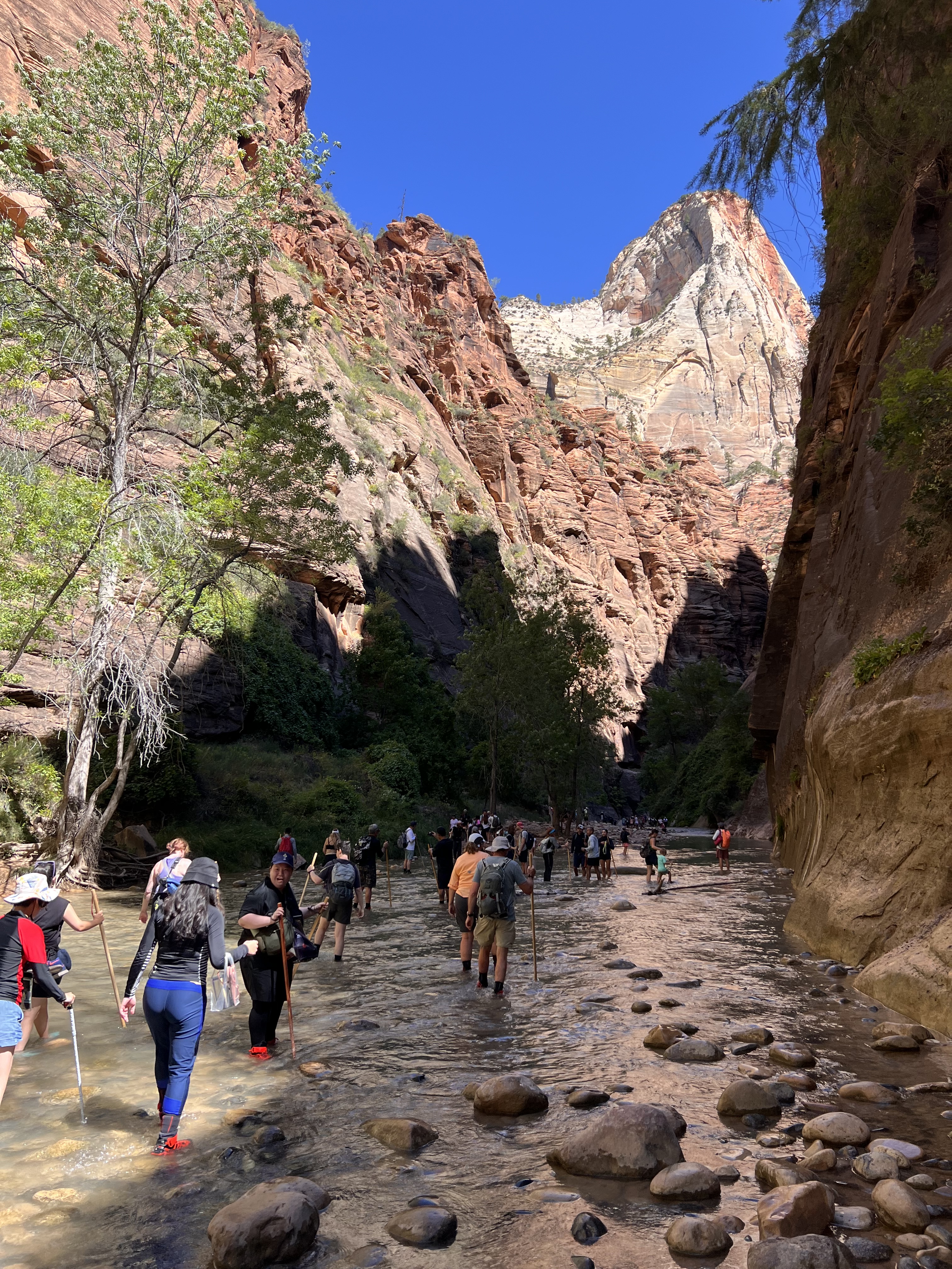
At Zion, you’re at the bottom of a canyon looking up. There’s a famous spot at the north end of the shuttle route called The Narrows, where part of the trail goes in (not alongside) the river. You need proper water shoes and walking sticks to do this, which outfitters will happily rent you. We walked the trail up to this point but just dipped our toes in the water.
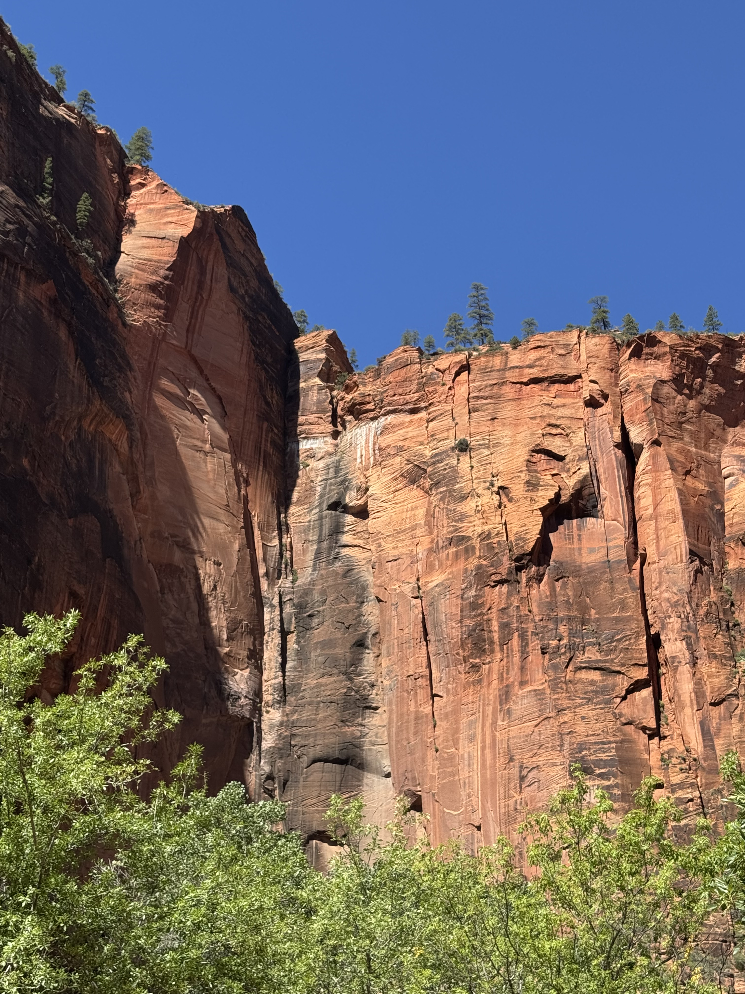
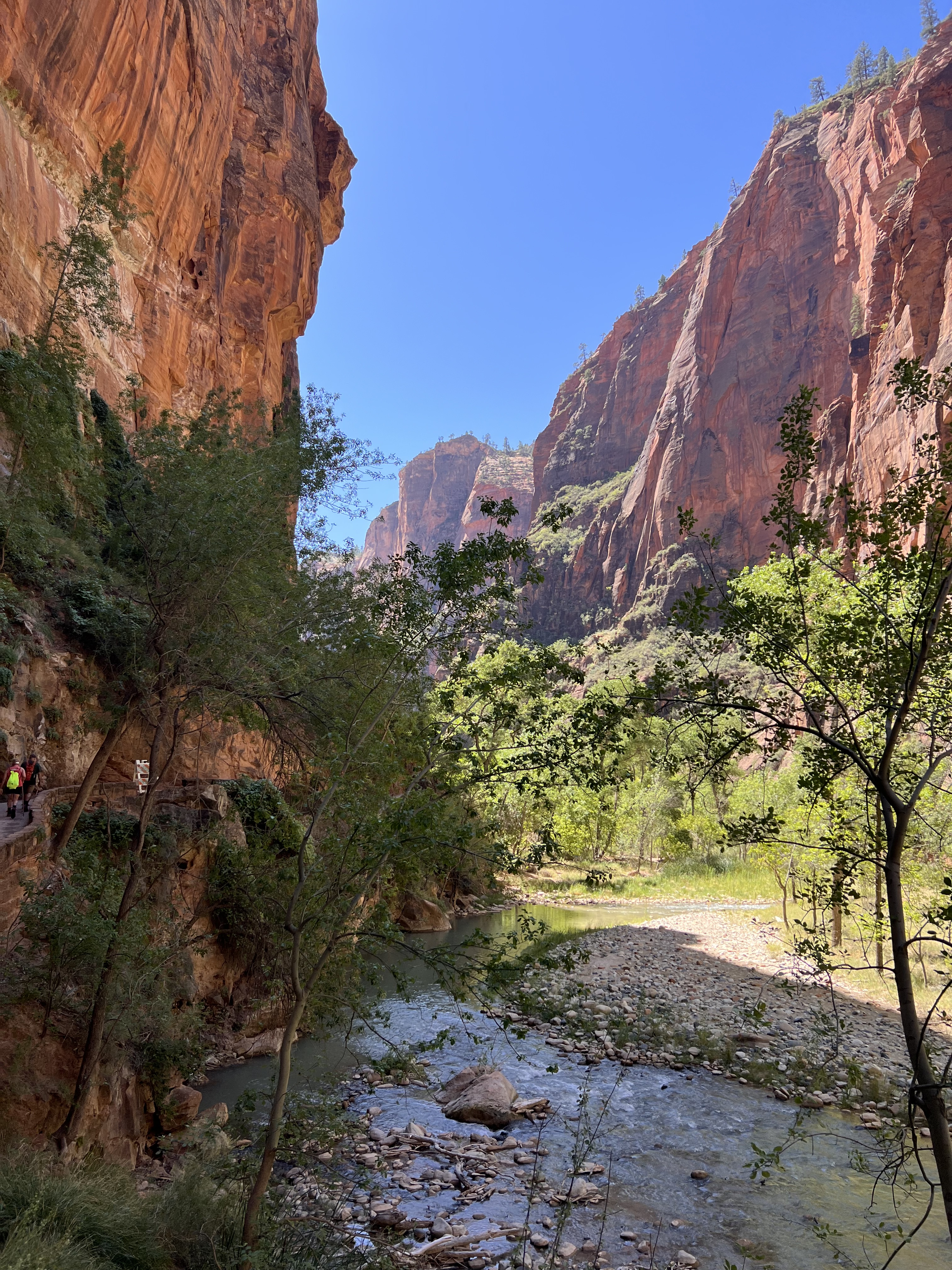
We’d probably have been more impressed with Zion if we’d seen it first. Zion is gorgeous but after seeing Arches and Bryce and all the other places on our trip, it was a little bit more-of-the-same. What we liked best about Zion was the greenery. The river at the bottom of the canyon sustains a greenbelt of trees and vegetation that made walking along the trails very pleasant and even shady in many places. The trees, the water and all the people made Zion “alive” for us.
Next morning, we left Zion along Utah 9, merged onto Interstate 15 and headed to Las Vegas airport. There we bid farewell to our trusty Outlander, having driven it about 1,400 miles, and caught our flight home.
If You Go
Here are a couple of random tips in case you ever plan to visit some or all of these parks.
A couple of weeks before our trip, we purchased an America the Beautiful national parks pass. This got us into all the national parks and monuments we visited. The price was very reasonable and the convenience of not having to pay at each park entrance was great especially since we entered several of the parks on consecutive days.
We found Ranger talks at national parks and guided tours in other places to be really worthwhile and informative. You can do a lot of research before your trip, but there’s nothing like listening to people with local knowledge and expertise, and having the opportunity to ask questions.
Arches National Park has a timed-entry ticket system to manage traffic. You have to reserve an entry time in advance for the days you want to enter the park. The fee is tiny, just a couple of bucks, but you need to do this before you arrive. Unless … you enter the park before 7:00 am or after 4:00 pm. At those times you don’t need a reservation. We only discovered this through a chance conversation with some other visitors. This helped us make a spur-of-the-moment decision to go to the park early one morning to catch the sunrise.
The simplest way to see Bryce Canyon is to drive all the way to the end of the Bryce Canyon Road to Rainbow Point and then work your way back stopping at all the viewpoints you’re interested in. That’s because the Canyon is located on the left side of the road as you enter the park. So as you drive back from Rainbow Point, they’re on your right.
Final Thoughts
This was a once-in-a-lifetime bucket list trip. There’s so much to see and do in this part of the country, we could have spent even more time there. The landscapes are beyond imagination. It’s hard to pick favorites, but if we had to select our top three, they’d be Monument Valley, Arches and Bryce Canyon.
Every one of the national, state and tribal parks we visited were well run and maintained. The staff and the Rangers were all very knowledgeable and helpful.
These places really are treasures.
Thanks for reading
Discover more from Unsolicited Feedback
Subscribe to get the latest posts sent to your email.

Thanks for sharing Harry! The photos are fantastic! I miss the road trips of yesteryears. Usually roadtrips call for a special playlist too. Curious if you had one.
On a side note, you may be interested in knowing that the Pando aspen forest competes with the Armillaria ostoyae, also known as the “humongous fungus”, found in Oregon, as the largest living organism. They estimate ‘humongous’ covers more than 2k acres.
https://www.discovermagazine.com/the-worlds-largest-organism-is-a-35-000-ton-fungus-at-least-for-now-47733
LikeLike
Thanks for sharing Harry! The photos are fantastic! I miss the road trips of yesteryears. Usually roadtrips call for a special playlist too. Curious if you had one.
On a side note, you may be interested in knowing that the Pando aspen forest competes with the Armillaria ostoyae, also known as the “humongous fungus”, found in Oregon, as the largest living organism. They estimate ‘humongous’ covers more than 2k acres.
https://www.discovermagazine.com/the-worlds-largest-organism-is-a-35-000-ton-fungus-at-least-for-now-47733
LikeLiked by 1 person
Thanks Michele! We did not have a playlist. Something to add to our next trip. I’m glad I can always count on you to keep me informed about anything fungus-related. 🙂
LikeLike
Wow – so many great photos, Harry! We did a quick tour through several of these areas back in 2010 (so long ago!). Seeing your photos brings back some great memories. Thanks for collating these and sharing some of the geological info too (I’d forgotten much of that part, if I learned it to begin with, ha).
LikeLiked by 1 person